Stellenbosch, Somerset West ve Strand'daki miras alanlarının listesi - List of heritage sites in Stellenbosch, Somerset West, and Strand
Bu bir listedir miras siteleri içinde Stellenbosch, Somerset West, ve İplik, yer almaktadır Western Cape tarafından tanınan Güney Afrika Miras Kaynak Ajansı.[1]
Stellenbosch kasabasındaki miras alanları
| SAHRA tanımlayıcı | Site adı | Açıklama | Kasaba | İlçe | NHRA durumu | Koordinatlar | Resim |
|---|---|---|---|---|---|---|---|
| 9/2/084/0001 | STELLENBOSCH BELEDİYE ALANI, GENEL | Stellenbosch | Stellenbosch |  | |||
| 9/2/084/0001-026 | Meşe ağaçları, Dorp Caddesi ve The Avenue, Stellenbosch | Dorp Caddesi, Cape Town'a giden eski vagon yoludur ve tıpkı üç yüzyıl önce olduğu gibi, ziyaretçiler hala aynı yoldan şehre girerler. Bu nedenle eski cadde haklı olarak Oaks Kasabası'na bir giriş işlevi görür, çünkü caddenin her iki tarafında, en büyük yaşlı devleri muhtemelen 1760'a kadar uzanan güzel, gölgeli ve kıvrımlı yaşlı meşe ağaçları görülür. Diğerlerinin yaşı 1812 yılına kadar uzanmaktadır. Sokakların genişlemesini zorunlu kılan modern trafikteki artış, bu ağaçların hayatını tehdit etmiş, ancak belediyenin samimi işbirliğiyle Dorp Caddesi'nde, demiryolu hattı ile demiryolu arasında Pastorie Caddesi ve Pastorie ile Van Riebeeck Sokakları arasındaki Caddede bulunanlar tarihi anıtlar ilan edildi. Ancak, yeni bir tehlike - yaprak yanması - şimdi bu eski ağaçları tehdit ediyor. 1950 ilan edildi. | Stellenbosch | Stellenbosch | İl Miras Alanı | 33 ° 55-56 ″ G 18 ° 51′37 ″ D / 33.932105 ° G 18.860152 ° D | |
| 9/2/084/0001-027 | Meşe ağaçları, Parsonage Caddesi, Church Caddesi, Drostdy Caddesi, Ryneveld Caddesi, Andringa Caddesi, Kuş Caddesi, Plein Caddesi ve Van Riebeeck Caddesi, Stellenbosch | 1968'de aşağıdaki sokaklardaki meşe ağaçları da tarihi anıtlar ilan edildi: Pastorie, Church, Drostdy, Ryneveld, Crozier, Andringa, Bird ve Van Riebeeck Sokakları. | Stellenbosch | Stellenbosch | İl Miras Alanı | 33 ° 56′16″ G 18 ° 51′44″ D / 33.937886 ° G 18.862112 ° D | 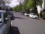 |
| 9/2/084/0002/03 | Ida Minor, Idas Vadisi, Stellebosch Bölgesi | Stellenbosch | Stellenbosch | Ulusal Anıt |  | ||
| 9/2/084/0002/18 | Wedgewood Çiftliği, Idas Vadisi, Stellebosch Bölgesi | Stellenbosch | Stellenbosch | Ulusal Anıt | | ||
| 9/2/084/0003 | Devonshire Evi, 13 Ryneveld Caddesi, Stellenbosch | Devonshire House, Stellenbosch'un en eski sokak köşesinde yer almaktadır ve buraya yaklaşık 1861 yılında inşa edilmiştir. Erken Viktorya tarzında çift katlı bir şehir evidir. | Stellenbosch | Stellenbosch | İl Miras Alanı | 33 ° 56′16″ G 18 ° 51′46″ D / 33.937676 ° G 18.862676 ° D |  |
| 9/2/084/0004 | Oude Leeskamer, 182 Dorp Caddesi, Stellenbosch | Bu bina aslen Landdrost ve Heemraden Koleji tarafından ofis olarak kullanılmıştır. Gymnasium olarak anılacak olan eğitim kurumunun kuruluş toplantısı 1863 yılında burada yapılmıştır. Gymnasium binasının 1866 yılında tamamlanmasından önce Oude Leeskamer üç ay boyunca okul binası olarak kullanılmıştır. | Stellenbosch | Stellenbosch | İl Miras Alanı | 33 ° 56′18″ G 18 ° 51′49″ D / 33.938426 ° G 18.863597 ° D | 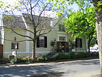 |
| 9/2/084/0005 | Mostertsdrift, Jonkershoek Yolu, Stellenbosch | Güney Afrika'daki Mostert ailesinin atalarının çiftliği olan Mostertsdrift, aynı zamanda kasabanın kendisinden çok daha eski olan çiftliklerden biridir. Johannes (Jan) Cornelisz Mostert eşi Alida van Hulst ile yaklaşık 1672'de Cape'e geldi. Simon van der Stel'in gelişinden kısa bir süre önce, Mostert ve Pieter Visagie'ye Tygerberg'in doğusundaki Buffelscop çiftliğini yetiştirme izni verildi. Ancak Buffelscop bir kredi çiftliğiydi ve Simon van der Stel Kasım 1679'da Eerste Nehri kıyılarına yerleşmek isteyen herkes için mülkiyet arazisinin açık olduğunu duyurduğunda, Jan Mostert tekliften yararlandı. Bugünkü yerleşim bölgesi Mostertsdrift'in bulunduğu Eerste Nehri'nin kuzey kıyısındaki güzel araziyi seçti. Mostertsdrift'in gölgeli meşe ağaçları arasında yer alan ve yüksek bir duvarla çevrili olan çiftlik evi, sadece Oaks Kasabası'nın erken tarihinin bir parçası değil, aynı zamanda eski moda, aristokrat çiftlik binaları grubunun da zarif bir örneğidir. Boland. | Stellenbosch | Stellenbosch | İl Miras Alanı | 33 ° 56′05 ″ G 18 ° 52′53″ D / 33.934683 ° G 18.881480 ° D |  |
| 9/2/084/0007 | Kromme Rhee, Koelenhof, Stellenbosch Bölgesi | Stellenbosch | Stellenbosch | Ulusal Anıt | 33 ° 52′21″ G 18 ° 49′36″ D / 33,872520 ° G 18,826700 ° D | | |
| 9/2/084/0009 | Stellenbosch Müzesi, 18 Ryneveld Caddesi, Stellenbosch | Stellenbosch | Stellenbosch | Ulusal Anıt | 33 ° 56′07 ″ G 18 ° 51′44″ D / 33.935410 ° G 18.862160 ° D | | |
| 9/2/084/0010 | Jannie Marais Evi, Coetzenburg, Noordwal East, Stellenbosch | Tarihi eski Coetzenburg çiftliği (şimdi Stellenbosch Jannie Marais Evi olarak bilinir), mahzen ve müştemilatların bulunduğu alan, evin kuzeyindeki ve Eerste Nehri kıyılarına kadar uzanan arazi kısmı ile birlikte. | Stellenbosch | Stellenbosch | İl Miras Alanı | 33 ° 56′17 ″ G 18 ° 52′12 ″ D / 33,938148 ° G 18,869973 ° D |  |
| 9/2/084/0011 | Die Laan, Stellenbosch | Stellenbosch | Stellenbosch | Ulusal Anıt | 33 ° 56′19″ G 18 ° 52′00 ″ D / 33.938617 ° G 18.866761 ° D |  | |
| 9/2/084/0011/002 | 24 Cadde, Stellenbosch | Mülk, Gürcü konutu ile birlikte. | Stellenbosch | Stellenbosch | İl Miras Alanı | 33 ° 55-56 ″ G 18 ° 51′37 ″ D / 33.932105 ° G 18.860152 ° D |  |
| 9/2/084/0011/004 | Moedersloon, 8 Cadde, Stellenbosch | Stellenbosch | Stellenbosch | İl Miras Alanı | 33 ° 55′03 ″ G 18 ° 50′40″ D / 33.917586 ° G 18.844440 ° D |  | |
| 9/2/084/0011/1 | 6 Die Laan, Stellenbosch | Stellenbosch | Stellenbosch | 33 ° 56′19″ G 18 ° 51′55″ D / 33,938502 ° G 18,865298 ° D | | ||
| 9/2/084/0011/3 | 22 Die Laan, Stellenbosch | Stellenbosch | Stellenbosch | Bekleyen Beyan | 33 ° 56′18″ G 18 ° 52′03 ″ D / 33.938254 ° G 18.867436 ° D | | |
| 9/2/084/0011/5 | 20 Die Laan, Stellenbosch | Stellenbosch | Stellenbosch | Ulusal Anıt | 33 ° 56′18″ G 18 ° 52′02 ″ D / 33.938272 ° G 18.867286 ° D | | |
| 9/2/084/0012 | Memurlar Dağınıklığı, 15 Market Caddesi, Stellenbosch | Esas olarak 19. yüzyıldan kalma bu ilginç mimari ev kompleksi, Market Caddesi'nin tüm batı tarafının ve Stellenbosch'un tarihi çekirdeğinin ayrılmaz bir parçasını oluşturur. | Stellenbosch | Stellenbosch | İl Miras Alanı | 33 ° 56′19″ G 18 ° 51′18″ D / 33.938580 ° G 18.854910 ° D | 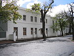 |
| 9/2/084/0013 | Homestead, Jonkershoek, Stellenbosch Bölgesi | Stellenbosch | Stellenbosch | Ulusal Anıt | | ||
| 9/2/084/0014 | Değirmen akışı, Stellenbosch | Değirmen akışının Mostertsdrift'teki Erf 1629'dan kuzey-batı yönünde Marais Caddesi'ne kadar uzanan kısmı; oradan batı yönünde Van Riebeeck Caddesi'nden Andringa Caddesi'ne kadar; oradan Erf 6460'ın doğu sınırına kadar güney-batı yönünde ve oradan Skone Uitsig ve Alexander Sokakları'nın kesişme noktasına kadar kuzey-batı yönünde. | Stellenbosch | Stellenbosch | İl Miras Alanı | 33 ° 56′14 ″ G 18 ° 52′13 ″ D / 33.937145 ° G 18.870370 ° D |  |
| 9/2/084/0015 | Proteahof, 80–120 Ryneveld Caddesi, Stellenbosch | 1860'tan kısa bir süre sonra inşa edilen bu bina kompleksi, başlangıçta eski köleler için bir konut planının bir parçasını oluşturuyordu. Evler restore edildi. | Stellenbosch | Stellenbosch | İl Miras Alanı | 33 ° 55′45″ G 18 ° 51′42″ D / 33.929300 ° G 18.861732 ° D | 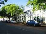 |
| 9/2/084/0016 | Stellenbosch'daki Tarihi Ağaçlar | Stellenbosch | Stellenbosch | Ulusal Anıt | | ||
| 9/2/084/0017 | 1 Herold Caddesi, Stellenbosch | Stellenbosch | Stellenbosch | 33 ° 56′24″ G 18 ° 51′09 ″ D / 33,939963 ° G 18,852531 ° D | | ||
| 9/2/084/0018 | Zevenrivieren, Banhoek, Stellenbosch Bölgesi | Stellenbosch | Stellenbosch | | |||
| 9/2/084/0019 | Stellenbosch Oteli, 160 Dorp Caddesi, Stellenbosch | Stellenbosch | Stellenbosch | İl Miras Alanı | 33 ° 56′19″ G 18 ° 51′45″ D / 33.9385833333 ° G 18.8626333333 ° D |  | |
| 9/2/084/0021 | Coachman's Cottage, 40 Alexander Street, Stellenbosch | Burgher Evi'nin karşısında, Bölünme Konseyi Ofislerinin yanında, önündeki çatı penceresi ve çekici içbükey dışbükey yan duvarları ile bu büyüleyici sazdan kır evi duruyor. | Stellenbosch | Stellenbosch | İl Miras Alanı | 33 ° 56′10″ G 18 ° 51′19″ D / 33.936078 ° G 18.855171 ° D |  |
| 9/2/084/0022 | Leef op Hoop / Klein Gustrouw, Jonkershoek, Stellenbosch Bölgesi | Stellenbosch | Stellenbosch | Ulusal Anıt | | ||
| 9/2/084/0023 | Lanzerac, Jonkershoek, Stellenbosch | 1692'de Isaac Schryver'e verildi. 1806'da çiftlik muhtemelen Lanzerac'ı Cape Dutch tarzında 1830 civarında inşa eden Coenraad Johannes Fick'e geçti. | Stellenbosch | Stellenbosch | İl Miras Alanı | 33 ° 56′16″ G 18 ° 53′39″ D / 33.937766 ° G 18.894109 ° D | 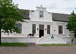 |
| 9/2/084/0024 | Ren Misyon Kilisesi, Blom Caddesi, Stellenbosch | Eksik bir T şeklinde inşa edilmiş ince duvarlarıyla şirin eski Ren Misyonu Kilisesi, Braak'ın güney tarafına bakar. Bu, Güney Afrika'daki en eski misyon kiliselerinden biridir. Güçlü Rönesans etkisine ihanet eden hassas mimari işlem, 19. yüzyılın başlarında mimarinin tipik bir örneğidir. Yapılış tarihi olan 1823'ü taşıyan kalkan, türünün en iyilerinden biridir. 1840'ta kuzey kanadı inşa edildi. | Stellenbosch | Stellenbosch | İl Miras Alanı | 33 ° 56′17 ″ G 18 ° 51′32″ D / 33.937932 ° G 18.858960 ° D |  |
| 9/2/084/0024/001 | Minber, Ren Misyonu Kilisesi, Blom Caddesi, Stellenbosch | Braak'a bakan Ren Kilisesi sadece tarihi ve mimari nitelikleri ile değil, aynı zamanda içindeki ince minber ile de bilinir. Kürsü ve kürsü 1853'te Simon Pieter Christoffel Londt tarafından yapılmıştır. | Stellenbosch | Stellenbosch | Miras Nesne | | |
| 9/2/084/0024/1 | Minber, Ren Kilisesi, Braak, Stellenbosch | Stellenbosch | Stellenbosch | Ulusal Anıt | 33 ° 56′16″ G 18 ° 51′32″ D / 33.937915 ° G 18.858939 ° D | | |
| 9/2/084/0027 | Schreuder Evi, 10 Ryneveld Caddesi, Stellenbosch | Bu kolonyal ev, 1709 yılında Sebastian Schreuder tarafından inşa edilmiştir ve Güney Afrika'daki bilinen en eski konuttur. | Stellenbosch | Stellenbosch | İl Miras Alanı | 33 ° 56′16″ G 18 ° 51′47″ D / 33.937642 ° G 18.862954 ° D |  |
| 9/2/084/0028 | 17 Van Riebeeck Caddesi, Stellenbosch | Stellenbosch | Stellenbosch | Ulusal Anıt | 33 ° 56′13 ″ G 18 ° 51′59″ D / 33.936842 ° G 18.866390 ° D | | |
| 9/2/084/0029 | Gujjatul İslam Jamaah Camii, Banhoek Yolu, Stellenbosch | Stellenbosch | Stellenbosch | 33 ° 55-50″ G 18 ° 51′33″ D / 33.930598 ° G 18.859172 ° D | | ||
| 9/2/084/0030 | Bergzicht Pazar Meydanı, Stellenbosch | Stellenbosch | Stellenbosch | | |||
| 9/2/084/0031 | 99 Dorp Caddesi, Stellenbosch | Stellenbosch | Stellenbosch | 33 ° 56′22″ G 18 ° 51′30″ D / 33.939360 ° G 18.858260 ° D | | ||
| 9/2/084/0034 | 21 Van Riebeeck Caddesi, Stellenbosch | Stellenbosch | Stellenbosch | Ulusal Anıt | 33 ° 56′13 ″ G 18 ° 52′01 ″ D / 33.937004 ° G 18.867003 ° D | | |
| 9/2/084/0035 | Ordu Kulübü, 15 Market Caddesi, Stellenbosch | Stellenbosch | Stellenbosch | 33 ° 56′20″ G 18 ° 51′17 ″ D / 33,938896 ° G 18,854645 ° D | | ||
| 9/2/084/0036 | Annandale Çiftliği, Stellenbosch | Stellenbosch | Stellenbosch | Ulusal Anıt | 33 ° 59′49 ″ G 18 ° 49′51″ D / 33.997071 ° G 18.830780 ° D | | |
| 9/2/084/0037 | 19 Riebeeck Caddesi, Stellenbosch | Stellenbosch | Stellenbosch | 33 ° 56′13 ″ G 18 ° 52′00 ″ D / 33.936897 ° G 18.866734 ° D | | ||
| 9/2/084/0038 | 137 Dorp Caddesi, Stellenbosch | Stellenbosch | Stellenbosch | 33 ° 56′20″ G 18 ° 51′38″ D / 33,939026 ° G 18,860650 ° D | | ||
| 9/2/084/0039 | Fynbos Konuk Evi, 14 Neethling Caddesi, Stellenbosch | Stellenbosch | Stellenbosch | Kayıt ol | 33 ° 56′14 ″ G 18 ° 52′00 ″ D / 33.937207 ° G 18.866592 ° D |  | |
| 9/2/084/0040 | 17 Market Caddesi, Stellenbosch | Stellenbosch | Stellenbosch | Kayıt ol | 33 ° 56′21″ G 18 ° 51′16″ D / 33.939140 ° G 18.854331 ° D | | |
| 9/2/084/0042 | 34 Kilise Sokağı, Stellenbosch | Stellenbosch | Stellenbosch | 33 ° 56′16″ G 18 ° 51′44″ D / 33.937888 ° G 18.862086 ° D | | ||
| 9/2/084/0043 | 36 Kilise Sokağı, Stellenbosch | Stellenbosch | Stellenbosch | 33 ° 56′16″ G 18 ° 51′44″ D / 33.937873 ° G 18.862226 ° D | | ||
| 9/2/084/0044 | Kromme Rivier, Paul Kruger Caddesi, Stellenbosch | Stellenbosch | Stellenbosch | 33 ° 55′40″ G 18 ° 51′24″ D / 33.927719 ° G 18.856642 ° D |  | ||
| 9/2/084/0044-001 | Kromme Rivier (Ahır), Hofman Caddesi, Stellenbosch | Krommerivier Barn olarak tanımlanan bina, Hofman ve Kruger Caddelerinin köşesinde yer almaktadır. Bu ahır, Stellenbosch'taki hayatta kalan en eski binalardan birinin 1850'lerden kalma bir rekonstrüksiyonudur: 1730'lardan kalma nadir bir uzun ek bina. Ahır, ambar ve ahır, depolama alanı ve insan yerleşimi olarak kullanılmıştır. | Stellenbosch | Stellenbosch | Kayıt ol | 33 ° 55′52″ G 18 ° 51′21″ D / 33.931045 ° G 18.855882 ° D | |
| 9/2/084/0045 | Voet van Helderberg, Stellenbosch | Stellenbosch | Stellenbosch | Bekleyen Beyan | 34 ° 02′09 ″ G 18 ° 51′41″ D / 34.035820 ° G 18.861434 ° D | | |
| 9/2/084/0046 | 176 Dorp Caddesi, Stellenbosch | Köle odalarına sahip bu tipik şehir evi, aslen 18. yüzyıldan kalmadır. Bina, Landdrost ve Heemraden Koleji Sekreterinin ikametgahı olduğunda 1813'te bugünkü haline değiştirildi. | Stellenbosch | Stellenbosch | İl Miras Alanı | 33 ° 56′18″ G 18 ° 51′48″ D / 33.938288 ° G 18.863297 ° D |  |
| 9/2/084/0047 | Bergzicht Farmstead, Stellenbosch | Stellenbosch | Stellenbosch | Ulusal Anıt | | ||
| 9/2/084/0048 | 3 Ryneveld Caddesi, Stellenbosch | Stellenbosch | Stellenbosch | İl Miras Alanı | 33 ° 56′17 ″ G 18 ° 51′47″ D / 33,938044 ° G 18,863027 ° D |  | |
| 9/2/084/0049 | Zorgvliet Batı, Stellenbosch | Stellenbosch | Stellenbosch | Ulusal Anıt | 33 ° 54′53 ″ G 18 ° 56′08 ″ D / 33.914589 ° G 18.935571 ° D | | |
| 9/2/084/0050 | Bletterman Evi, Plein Caddesi, Stellenbosch | Stellenbosch | Stellenbosch | İl Miras Alanı | 33 ° 56′13 ″ G 18 ° 51′40″ D / 33,937051 ° G 18,861015 ° D |  | |
| 9/2/084/0051 | Grosvenor Evi, Drostdy Caddesi, Stellenbosch | Grosvenor House, Drostdy Caddesi'ndeki Hollanda Reform Kilisesi'nin yanında yer almaktadır. Grosvenor House, en eski ve en iyi bilinen Stellenbosch ve dolayısıyla Güney Afrikalı aileler ile ilişkilidir. Üzerinde bulunduğu arazi 1781'de Christiaan Ludolph Neethling'e verildi. 1741'de Almanya'dan Cape'e gelerek bu yaygın Afrikaans ailesinin atası oldu. Bina ayrıca basit bir yapının nasıl Cape mimarisinin değerli bir örneğine dönüşebileceğinin açık bir gösterimini sağlıyor. Christiaan Neethling'in inşa ettiği ev, Drostdy Caddesi'ndeki bir sıra tek katlı sazdan odalardan oluşuyordu. 18. yüzyılın sonunda ve 19. yüzyılın başında, ön kapının üstüne bir kalkan eklenmiş ve arka tarafa binaya T şeklini veren bir oda inşa edilmiştir. Daha sonra eklemeler onu tam ölçekli bir H- şekilli ev. Hasta yorgan, Herold, F, ilk başta muhtemelen evin ön kısmıyla sınırlı olan bir değişiklik olan, düz çatılı ikinci bir kat ekledi. Bu değişiklikler eve tamamen yeni bir cephe kazandırdı: Zengin süslemeli kornişli dört yivli pilaster; daha kısa, nervürlü pilasterlerle çerçevelenmiş tik ahır kapı; kokuşmuş ağaçtan iç panjurları olan tik kanatlı pencereler ve sağ üstte, topluluğun tepesinden alınmış, kabartmalı küçük bir palmiye ağacı. Ev bugün hala böyle duruyor. Ana evin her iki tarafındaki müştemilatlar da muhtemelen Herold zamanında inşa edilmiştir. Geç Gürcü tarzı moda olduğu sırada evi işgal eden Frederick Neethling, muhtemelen vagon tekerleği fan ışığından sorumluydu. Kendi başına bir kültür hazinesi olan ev, Stellenbosch ve çevresinin tarihi kalıntıları için değerli bir depodur. | Stellenbosch | Stellenbosch | İl Miras Alanı | 33 ° 56′07 ″ G 18 ° 51′44″ D / 33.935358 ° G 18.862229 ° D |  |
| 9/2/084/0052 | Eski Üniversite Binaları, Stellenbosch | Stellenbosch | Stellenbosch | Ulusal Anıt | | ||
| 9/2/084/0053 | 5 Minserie Caddesi, Stellenbosch | Stellenbosch | Stellenbosch | İl Miras Alanı | 33 ° 56′15 ″ G 18 ° 51′53 ″ D / 33.937436 ° G 18.864742 ° D |  | |
| 9/2/084/0054 | Erfurt evi, 37 Ryneveld Caddesi, Stellenbosch | Stellenbosch | Stellenbosch | Ulusal Anıt | 33 ° 56′07 ″ G 18 ° 51′44″ D / 33.935327 ° G 18.862185 ° D | | |
| 9/2/084/0055 | Ren Papaz evi kompleksi, Market Caddesi, Stellenbosch | 1785 yılında Marthinus Byleveld'e verilen arazi üzerine inşa edilen Ren Papaz Evi Kompleksi'nin tüm binaları 19. yüzyılın başlarından kalmadır. Ana bina, Ren Kilisesi'nin eski papaz evidir ve 1815'ten kalmadır. H şeklindeki bu papaz evinin arka kanatlarından biri, kompleksin bir bölümünü oluşturan diğer iki bina ile bağlantılıdır. Bunlardan Leipoldt Evi olarak adlandırılan ve büyük oranlarıyla yaklaşık 1832 yılına tarihlenirken, alçak çatı çatılı üçüncü bina yaklaşık 1860 yılında çift katlı bir yapıya dönüştürülmüştür. Bir tarafta, Rhenish Papaz Evi Kompleksi uzun bir bina ile çevrilidir. dairesel duvar. | Stellenbosch | Stellenbosch | İl Miras Alanı | 33 ° 56′19″ G 18 ° 51′18″ D / 33.938580 ° G 18.854910 ° D |  |
| 9/2/084/0056 | 2 Ryneveld Caddesi, Stellenbosch | Stellenbosch | Stellenbosch | Ulusal Anıt | 33 ° 56′17 ″ G 18 ° 51′47″ D / 33.938129 ° G 18.863070 ° D | | |
| 9/2/084/0057 | Alto, Annendale Yolu, Stellenbosch Bölgesi | Stellenbosch | Stellenbosch | Ulusal Anıt (?) | 34 ° 00′10 ″ G 18 ° 50′49″ D / 34.002838 ° G 18.846985 ° D | | |
| 9/2/084/0058 | Erf 3759, Schroder Caddesi, Stellenbosch | Stellenbosch | Stellenbosch | | |||
| 9/2/084/0059 | Faure Evi, Stellenbosch | Stellenbosch | Stellenbosch | 34 ° 01′36″ G 18 ° 44′56″ D / 34.026677 ° G 18.748852 ° D | | ||
| 9/2/084/0060 | Van der Bijl Evi, 37 Market Caddesi, Stellenbosch | Bu mülk, Oude Molen olarak bilinen eski çiftliğin bir bölümünü oluşturur. Adriaan Roux, mülkü 1806'da satın almış ve kısa bir süre sonra şimdiki evi inşa etmiştir. 1848'den beri Van der Bijl ailesinin mülkiyetindedir. | Stellenbosch | Stellenbosch | İl Miras Alanı | 33 ° 56′19″ G 18 ° 51′18″ D / 33.938580 ° G 18.854910 ° D | 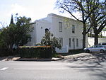 |
| 9/2/084/0060/001 | Van der Bijl Kır Evi, 37A Market Caddesi, Stellenbosch | Orijinal iki odalı Van der Bijl kır evi, M.Ö. 1820, muhtemelen bir bahçıvan kulübesi olarak. Bina, 1979-1980'deki restorasyonu sırasında genişletilmesine rağmen, orijinal karakterinin ve ölçeğinin çoğunu korumaktadır. Tarihi Van der Bijl Evi kompleksinin bir parçası olarak, yazlık sadece bu Ulusal Anıtın önemli ve ayrılmaz bir parçasını oluşturmakla kalmaz, aynı zamanda çevredeki tarihi sokak manzarasına da katkıda bulunur. | Stellenbosch | Stellenbosch | Kayıt ol | 33 ° 56′19″ G 18 ° 51′17 ″ D / 33.938527 ° G 18.854792 ° D |  |
| 9/2/084/0061 | 155 Dorp Caddesi, Stellenbosch | 153, 155 ve 157 no'lu üç tek katlı yarı müstakil ev hala birbirine bağlı olduğu gibi, yıllar boyunca onları işgal eden çeşitli aileler de sıklıkla bağlantılıydı. 155 ve 157 Dorp Caddesi mütevazı duvarlarıyla ve mimari açıdan da önemli. | Stellenbosch | Stellenbosch | İl Miras Alanı | 33 ° 56′20″ G 18 ° 51′44″ D / 33.9387694444 ° G 18.8622333333 ° D |  |
| 9/2/084/0062 | Braak, Stellenbosch | Kasaba ortak (Braak kuzeyde Alexander Street, doğuda Bird Street, Mill Square ve Church of the Rhenish Mission ile, güneyde JW Palen'e aktarılan mülk ile ve batıda Bloem Street ile sınırlanan "nadas arazi" anlamına gelir) ve Ren Misyonu Kilisesi. | Stellenbosch | Stellenbosch | İl Miras Alanı | 33 ° 56′14 ″ G 18 ° 51′31″ D / 33.937097 ° G 18.858676 ° D | 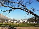 |
| 9/2/084/0063 | Powder Magazine, Blom Caddesi, Stellenbosch | Braak, eşsiz karakterini etrafını saran binalardan alıyor ve bunlardan biri de tanınmış Powder Magazine. Stellenbosch askeri tarihinin küçük bir kalıntı müzesine dönüştürülmüştür. | Stellenbosch | Stellenbosch | İl Miras Alanı | 33 ° 56′13 ″ G 18 ° 51′30″ D / 33.937069 ° G 18.858274 ° D |  |
| 9/2/084/0064 | La Gratitude, 95 Dorp Caddesi, Stellenbosch | La Gratitude, 1786'dan 1830'a kadar Stellenbosch'ta papaz olan Rev. Meent Borcherds tarafından 1798'de inşa edildi. 1762'de Jangum, East Friesland'da doğdu. Ev, en eski neo- klasik pilaster-ızgaralar. Pilastörler pencereler arasında tekrar edilir. Bu, cepheye olağanüstü bir haysiyet kazandırır ve aristokratik bir gurur havası yaratır. | Stellenbosch | Stellenbosch | İl Miras Alanı | 33 ° 56′21″ G 18 ° 51′29″ D / 33.939206 ° G 18.857919 ° D | 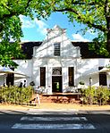 |
| 9/2/084/0065 | Tuinpoort, Plein Caddesi, Stellenbosch | Stellenbosch'un en eski üç caddesinden biri olan Plein Caddesi, Braak'tan kasabanın içinden Jonkershoek'e kadar uzanıyor. Neredeyse modern iş binaları arasında gizlenmiş olan Belediye Binası'nın karşısında, 19. yüzyılın sonunda Plein Caddesi'nde duran tarzda güzel barok duvarlara sahip çekici küçük bir geçit var. Uzun yıllar eski mezarlığın girişi olduğu düşünülüyordu, ancak daha sonra yapılan araştırmalar ve Stellenbosch'un 1710'da yapılan bir çizimi durumun böyle olamayacağını kanıtlıyor. Artık eski mezarlığa giriş olarak kabul edilemeyeceği gerçeği, güzelliğinden, mimari ve kültürel-tarihi değerlerinden hiçbir şekilde uzaklaşmamaktadır. | Stellenbosch | Stellenbosch | İl Miras Alanı | 33 ° 56′13 ″ G 18 ° 51′40″ D / 33,937051 ° G 18,861015 ° D |  |
| 9/2/084/0066 | Burgher Evi, Blom Caddesi, Stellenbosch | Braak'ın çevresinde başka istisnai binalar da vardır; Bunlardan en çarpıcılarından biri, erken pilasterli ince cephesi ile Burgher Evi. 18. yüzyılın sonlarına tarihlenir ve Anthonie Fick tarafından inşa edilen birkaç evden biridir. Fick araziyi 1796'da veya bu tarihten hemen önce satın aldı ve ertesi yıl bu ev çoktan inşa edilmişti. Zamanla binada kesinlikle birkaç değişiklik yapıldı, ancak başlangıçta bir H şeklinde inşa edildi ve ön kapının üzerindeki kendine özgü tuğla ve alçı arşitrav hayatta kaldı. Bu ev, Old Cape Dutch mimarisinin son derece güzel bir örneğidir. | Stellenbosch | Stellenbosch | İl Miras Alanı | 33 ° 56′13 ″ G 18 ° 51′30″ D / 33.936980 ° G 18.858255 ° D |  |
| 9/2/084/0068 | Saat, Yönetim Binası B, Stellenbosch Üniversitesi, Victoria Caddesi, Stellenbosch | Kokuşmuş odun, sarı ağaç ve abanozdan yapılmış saat kasası çok zariftir. Oyma, kalıplanmış ayaklara dayanan ağır taban özellikle dikkat çekicidir. Tabandan zarif, ince kasa yükseliyor. Saat muhtemelen 18. yüzyılda Cape'de yapılan hayatta kalan tek saattir. 1765 yılında Almanya'da Furfeld'den Bleijswijk gemisiyle Cape'e gelen Johann Michael Junck tarafından yapılmıştır. Bu eski büyükbaba saati, 18. yüzyılda Cape'de uygulanan ince işçiliğin olağanüstü bir örneğidir. | Stellenbosch | Stellenbosch | Miras Nesne |  | |
| 9/2/084/0069 | St Mary Kilisesi, Braak, Stellenbosch | St. Mary Kilisesi, Drostdy Hotel'in karşısındaki Braak'ın köşesinde yer almaktadır. Sazdan çatısı olan bu ilginç kilise, aslında Braak tarihinin bir parçası haline geldi ve Ren Kilisesi ve Powder Dergisi gibi, karakterine önemli bir katkı sağlıyor. Bu mülk, mimari değerleri ve Braak'taki konumu nedeniyle tarihi bir anıt olarak kabul edilmektedir. | Stellenbosch | Stellenbosch | İl Miras Alanı | 33 ° 56′14 ″ G 18 ° 51′31″ D / 33.937097 ° G 18.858676 ° D |  |
| 9/2/084/0070 | Bölge Konseyi Binası, 46 Alexander Caddesi, Stellenbosch | Divisional Council Ofisleri ve Drostdy Hotel, Coachman’s Cottage denilen kulübenin hemen üzerinde yer almaktadır. İlki nispeten yeni bir bina iken, Drostdy Hotel daha eski ve kendi geçmişine sahip. Bu binaların ilanını kesinlikle tarihi gerekçelerle haklı çıkarmak zor olsa da, önemli bir mimari değere sahiptirler ve Braak ve çevresindeki binalarla uyumlu olacak kadar karakterlidirler. Bu nedenlerle ve bu alanın ahenkli görünümünün korunmasını sağlamak için bu yapıların Braak'a bakan cepheleri ilan edilmiştir. | Stellenbosch | Stellenbosch | İl Miras Alanı | 33 ° 56′10″ G 18 ° 51′18″ D / 33.936236 ° G 18.855138 ° D |  |
| 9/2/084/0071 | Birinci Gymnasium, 120 Dorp Caddesi, Stellenbosch | Dorp Caddesi'nin sol tarafındaki La Gratitude'dan biraz daha yukarıda, kendine özgü bir verandası olan mütevazı küçük bir bina duruyor. Sıkıştığı diğer binalar arasında oldukça yerinde görünmüyor. Bu, Paul Roos Gymnasium ve Stellenbosch Üniversitesi'nin geliştiği Stellenbosch Gymnasium'udur. | Stellenbosch | Stellenbosch | İl Miras Alanı | 33 ° 56′23″ G 18 ° 51′23″ D / 33.939601 ° G 18.856342 ° D |  |
| 9/2/084/0072 | Old Rhenish School Hostel, 3 Blom Caddesi, Stellenbosch | Braak'ın batı tarafında, ünlü küçük Ren Kilisesi'nden çok uzak olmayan bir yerde, ülkemizdeki en eski yatılı kız okulu olan Rhenish Hostel bulunmaktadır. Binanın tarihi öneminin yanı sıra, ilginç mimari tarzı, 19. yüzyılın başlarından kalma bir şehir meydanı olarak Braak'a özel bir karakter kazandırıyor. Ren Kilisesi, Burgher Evi, St. Mary Kilisesi, Arabacı Evi, Laetitia ve diğer binalar ile meydan benzersiz bir mimari kompleks oluşturur. | Stellenbosch | Stellenbosch | İl Miras Alanı | 33 ° 55′48″ G 18 ° 40-45″ D / 33,929920 ° G 18,679160 ° D | 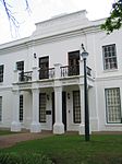 |
| 9/2/084/0073 | Saxenhof, 159 Dorp Caddesi, Stellenbosch | Çift katlı ev Saxenhof, eskiden Neethling Evi olarak da biliniyordu. Bu evin bulunduğu arazi, daha 1704 yılında Pieter Andriesz Saxe'ye verildi. Yerin on altı yıllığına sahip olduğu ve orijinal H şeklindeki Cape Dutch evini kendisi inşa ettiği kabul edildi. 1889'da ev Dr. Johannes Henoch Neethling'e satıldı ve kısa süre sonra eski tek katlı evi büyüleyici bir Gürcü tipi çift katlı eve dönüştürdü. Eski evin orijinal ve güzel eski tavanlarının yanı sıra birkaç yan ve arka pencereleri sağlam tutuldu. | Stellenbosch | Stellenbosch | İl Miras Alanı | 33 ° 56′20″ G 18 ° 51′45″ D / 33.9387833333 ° G 18.8625166666 ° D |  |
| 9/2/084/0074 | Hauptfleisch Evi, 153 Dorp Caddesi, Stellenbosch | 153, 155 ve 157 no'lu üç tek katlı yarı müstakil ev hala birbirine bağlı olduğu gibi, yıllar boyunca onları işgal eden çeşitli aileler de sıklıkla bağlantılıydı. | Stellenbosch | Stellenbosch | İl Miras Alanı | 33 ° 56′20″ G 18 ° 51′43″ D / 33.9388194444 ° G 18.8620777777 ° D |  |
| 9/2/084/0075 | Vredelus ve Klein Vredelus, 63 Dorp Caddesi, Stellenbosch | Bu eski ev, beyaz bir duvarın ve yüce meşe ağaçları, gür çalılar, çimler ve çiçeklerle dolu geniş bir bahçenin arkasına gizlendiği için özel bir çekicilik ve gizemliliğe sahiptir. Evler, 18. ve 19. yüzyıllar arasında Stellenbosch mimarisinin güzel örnekleridir ve aynı zamanda tarihi açıdan ilgi çekicidir. Historic Houses Limited tarafından restore edilmiş ve Stellenbosch kasabasına özel bir karakter kazandırmıştır. | Stellenbosch | Stellenbosch | İl Miras Alanı | 33 ° 56′25″ G 18 ° 51′18″ D / 33.940265 ° G 18.854940 ° D | 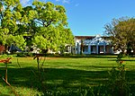 |
| 9/2/084/0076 | Loubscher Evi, 157 Dorp Caddesi, Stellenbosch | 153, 155 ve 157 numaralardaki üç tek katlı yarı müstakil ev hala birbirine bağlı olduğu gibi, yıllar boyunca onları işgal eden çeşitli aileler de sıklıkla bağlantılıydı. 155 ve 157 no'lu mütevazı duvarları da mimari açıdan önemlidir. No: 157 Dorp Caddesi, gerçekten de üçgen pencerenin her iki yanındaki pilasterlerde yuvarlak motifli birkaç evden biridir. | Stellenbosch | Stellenbosch | İl Miras Alanı | 33 ° 56′19″ G 18 ° 51′44″ D / 33.9386194444 ° G 18.8623472222 ° D |  |
| 9/2/084/0077 | Ou Bakhuis, 152 ve 154 Dorp Caddesi, Stellenbosch | Stellenbosch | Stellenbosch | İl Miras Alanı | 33 ° 56′19″ G 18 ° 51′44″ D / 33.9386444444 ° G 18.8621388888 ° D |  | |
| 9/2/084/0078 | Libertas Parva, Dorp Caddesi, Stellenbosch | Dorp Caddesi'nin Somerset West Road ile oluşturduğu köşedeki tren istasyonuna kısa bir mesafede, bu caddedeki ilk dikkat çekici eski ev duruyor. Libertas Parva veya Little Libertas olarak adlandırılır ve caddenin sağ tarafında (şimdi Rembrandt van Rijn Sanat Merkezi). Evin en eski özelliği dört yan duvarıdır; holbol tipindedirler, ancak içbükeylerin ve dışbükeylerin Zevenrivieren-Hazendal tipinin ön duvarlarındaki benzer bir eğilimi anımsatan dalgalı çizgilere ayrıldığını gösterirler, c, 1790. Bu nedenle ev 1783 veya daha sonra olabilir. . Philip Jacob Haupt, çiftliği 1819'da satın aldı ve hemen hemen düz hatlarla, iki ön kapı ve ayrıca Gürcü pencereleri ile mevcut ön ızgaranın inşa edilmesinden sorumlu olduğu kabul edilmelidir. Dış çevreleyen pilasterler, dış üçgen pilasterleri oluşturmak için yukarı doğru devam eder. Libertas Parva bina kompleksi, 18. ve 19. yüzyıllarda Stellenbosch mimarisinin güzel bir örneğidir ve köyün o kısmına özel bir karakter kazandırır. Ünlü Stellenbosch ailelerinin evi olarak, aynı zamanda büyük bir tarihi değere sahiptir. | Stellenbosch | Stellenbosch | İl Miras Alanı | 33 ° 56′23″ G 18 ° 51′23″ D / 33.939601 ° G 18.856342 ° D |  |
| 9/2/084/0079 | Diaconies Remise, 156 Dorp Street, Stellenbosch | 156 Dorp Caddesi, Diaconies Remise'ın saygıdeğer adını taşımaktadır ve tarihi ve mimari değeri nedeniyle Historical Homes of South Africa Ltd. tarafından satın alınmıştır. Mimari tarzı, 19. yüzyılın ilk on yılında inşa edildiğini gösterir. Ev aynı zamanda ana binanın yanında otantik kemerli bir geçidi olan çok az sayıdaki evden biridir. Bu kapı, sokaktan arka bahçeye erişim sağlar. | Stellenbosch | Stellenbosch | İl Miras Alanı | 33 ° 56′19″ G 18 ° 51′39 ″ D / 33.9384972222 ° G 18.8609694444 ° D |  |
| 9/2/084/0080 | Laetitia Binası, 44 Alexander Caddesi, Stellenbosch | Coachman’s Cottage denen kulübenin hemen yukarısında, Braak'a bakan, çift katlı, düz çatılı bir ev olan Laetitia yer alır. 1968'de Laetitia, Güney Afrika'nın Tarihi Evleri Ltd. tarafından restore edildi. Belirli bir mimari tarzın temsilcisi olan ve Braak'ın kuzeybatı köşesinde önemli bir konumda bulunan Laetitia, Stellenbosch'taki bu eşsiz meydanın önemini ve cazibesini artırıyor. | Stellenbosch | Stellenbosch | İl Miras Alanı | 33 ° 56′08″ G 18 ° 51′29″ D / 33.935611 ° G 18.857924 ° D |  |
| 9/2/084/0081 | 158 Dorp Caddesi, Stellenbosch | Stellenbosch | Stellenbosch | İl Miras Alanı | 33 ° 56′19″ G 18 ° 51′40″ D / 33.9385194444 ° G 18.8611472222 ° D |  | |
| 9/2/084/0082 | Eski Evanjelist Lutheran Kilisesi, Dorp Caddesi, Stellenbosch | Neo-Gotik tarzdaki bu bina, Carl Otto Hager tarafından tasarlanmış ve inşa edilmiştir. Başlangıçta 28 Kasım 1854'te kutsandıktan sonra Lutheran Kilisesi olarak kullanılmıştır. | Stellenbosch | Stellenbosch | İl Miras Alanı | 33 ° 56′23″ G 18 ° 51′23″ D / 33.939601 ° G 18.856342 ° D |  |
| 9/2/084/0083 | Old Main Building, University of Stellenbosch, Ryneveld Street, Stellenbosch | This building was erected between 1880 and 1886 to provide proper housing for the Stellenbosch College. This so-called Main Building is in the Neo-Classical style, Carl Hager being the architect, and played an important part in the history of the Victoria College and later the University of Stellenbosch. | Stellenbosch | Stellenbosch | İl Miras Alanı | 33°55′53″S 18 ° 51′43″ D / 33.931433°S 18.862026°E |  |
| 9/2/084/0084 | Entrance and gates, Seminary, 171 Dorp Street, Stellenbosch | The gateway and gates which were erected at about 1769 as part of the Drostdy at that time, are situated on the most historic site in Stellenbosch. This site has associations with Simon van der Stel and the respective Drostdy buildings were formerly also situated here until, in 1859, they became the seat of the Theological Seminary. | Stellenbosch | Stellenbosch | İl Miras Alanı | 33 ° 56′19″ G 18°51′50″E / 33.938563°S 18.863925°E |  |
| 9/2/084/0085 | 37, 39 and 41 Herte Street, Stellenbosch | These historic double-storeyed houses were erected in about 1841 as residences for Coloured people and freed slaves and their descendants. | Stellenbosch | Stellenbosch | İl Miras Alanı | 33°56′15″S 18°51′20″E / 33.937484°S 18.855472°E |  |
| 9/2/084/0086 | 48 and 50 Dorp Street, Stellenbosch | This imposing architectural complex consists of a Cape Dutch house which was erected in about 1815 and a double-storeyed annex which dates back to about 1960. The property is closely associated with two well-known Stellenbosch families, i.e. the Neethlings and Ackermanns. | Stellenbosch | Stellenbosch | İl Miras Alanı | 33°56′23″S 18 ° 51′14″ D / 33.939673°S 18.853993°E |  |
| 9/2/084/0090 | Transvalia, 127 Dorp Street, Stellenbosch | These double-storeyed buildings, in the predominantly Georgian style, probably all date from the beginning of the 19th century. This group of houses forms an almost perfect unit and also forms an important element in the street scene of the historic Dorp Street. | Stellenbosch | Stellenbosch | İl Miras Alanı | 33°56′20″S 18 ° 51′32″ D / 33.938989°S 18.858848°E |  |
| 9/2/084/0091 | Alma, 129 Dorp Street, Stellenbosch | These double-storeyed buildings, in the predominantly Georgian style, probably all date from the beginning of the 19th century. This group of houses forms an almost perfect unit and also forms an important element in the street scene of the historic Dorp Street. | Stellenbosch | Stellenbosch | İl Miras Alanı | 33°56′20″S 18°51′39″E / 33.938765°S 18.860952°E |  |
| 9/2/084/0092 | Bosman House, 133 Dorp Street, Stellenbosch | These double-storeyed buildings, in the predominantly Georgian style, probably all date from the beginning of the 19th century. This group of houses forms an almost perfect unit and also forms an important element in the street scene of the historic Dorp Street. | Stellenbosch | Stellenbosch | İl Miras Alanı | 33°56′20″S 18°51′39″E / 33.938776°S 18.860953°E |  |
| 9/2/084/0093 | Tinetta House, 135 Dorp Street, Stellenbosch | These double-storeyed buildings, in the predominantly Georgian style, probably all date from the beginning of the 19th century. This group of houses forms an almost perfect unit and also forms an important element in the street scene of the historic Dorp Street. | Stellenbosch | Stellenbosch | İl Miras Alanı | 33°56′20″S 18°51′39″E / 33.938765°S 18.860953°E |  |
| 9/2/084/0094 | 8 Herte Street, Stellenbosch | These properties were granted in 1750 to the landdrost and Heemrade, and to Jan Greyling. The complex of buildings is of special architectural interest and forms an essential part of the historic core of Stellenbosch. | Stellenbosch | Stellenbosch | İl Miras Alanı | 33°56′21″S 18°51′22″E / 33.939113°S 18.856179°E |  |
| 9/2/084/0095 | 15 Herte Street, Stellenbosch | These properties were granted in 1750 to the landdrost and Heemrade, and to Jan Greyling. The complex of buildings is of special architectural interest and forms an essential part of the historic core of Stellenbosch. | Stellenbosch | Stellenbosch | İl Miras Alanı | 33°56′20″S 18 ° 51′21″ D / 33.938866°S 18.855720°E |  |
| 9/2/084/0096 | 19 Herte Street, Stellenbosch | These properties were granted in 1750 to the landdrost and Heemrade, and to Jan Greyling. The complex of buildings is of special architectural interest and forms an essential part of the historic core of Stellenbosch. | Stellenbosch | Stellenbosch | İl Miras Alanı | 33 ° 56′18″ G 18 ° 51′21″ D / 33.938459°S 18.855969°E |  |
| 9/2/084/0097 | 21 Herte Street, Stellenbosch | These properties were granted in 1750 to the landdrost and Heemrade, and to Jan Greyling. The complex of buildings is of special architectural interest and forms an essential part of the historic core of Stellenbosch. | Stellenbosch | Stellenbosch | İl Miras Alanı | 33 ° 56′17 ″ G 18 ° 51′21″ D / 33.938185°S 18.855896°E |  |
| 9/2/084/0098 | 23 Herte Street, Stellenbosch | These properties were granted in 1750 to the landdrost and Heemrade, and to Jan Greyling. The complex of buildings is of special architectural interest and forms an essential part of the historic core of Stellenbosch. | Stellenbosch | Stellenbosch | İl Miras Alanı | 33 ° 56′17 ″ G 18 ° 51′21″ D / 33.938117°S 18.855852°E |  |
| 9/2/084/0099 | Dutch Reformed Mother Church, Drostdy Street, Stellenbosch | A portion of this building originally formed part of the Stellenbosch cruciform church which was erected between 1719 and 1723. In 1862 the church was enlarged and altered in the neo-Gothic style by the architect Carl Otto Hager. The church was consecrated on 31 October 1863. | Stellenbosch | Stellenbosch | İl Miras Alanı | 33 ° 56′16″ G 18°51′49″E / 33.937710°S 18.863718°E |  |
| 9/2/084/0100 | Utopia, 1 Drostdy Street, Stellenbosch | This imposing H-shaped Cape Dutch house was built at the end of the 18th century for Philip Hartog. | Stellenbosch | Stellenbosch | İl Miras Alanı | 33 ° 56′16″ G 18°51′49″E / 33.937710°S 18.863718°E |  |
| 9/2/084/0102 | Wilgenhof, Ryneveld Street, Stellenbosch | The original portion of the historic Bachelors building was erected between 1786 and 1799. The building was later altered into a double-storeyed Georgian house and it was taken into use in 1903 as a boarding establishment for students. It is the oldest portion of the oldest university residence of Stellenbosch and many well-known personalities in the public life of South Africa lodged here during their student years. | Stellenbosch | Stellenbosch | İl Miras Alanı | 33°55′55″S 18 ° 51′43″ D / 33.931876°S 18.862083°E | 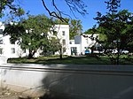 |
| 9/2/084/0103 | 105 Dorp Street, Stellenbosch | This historic dwelling-house is a typical double-storeyed town house of the second half of the 19th century. The property forms an essential part of the traditional architectural street scene of Dorp Street, and thus also of the historic core of Stellenbosch. | Stellenbosch | Stellenbosch | İl Miras Alanı | 33°56′22″S 18°51′31″E / 33.939350°S 18.858660°E |  |
| 9/2/084/0104 | Voorgelegen, 116 and 118 Dorp Street, Stellenbosch | This property originally formed part of De Nieuwe Molen, which was granted to the Landdros and Heemrade in 1750. In 1797 it became the property of Johannes Victor, who almost immediately erected the original H-shaped Cape Dutch house. In the second half of the 19th century the building was converted to a Georgian double-storey residence. Together with the outbuildings and the garden ring-wall it forms an outstanding group of buildings from the point of view of architecture and town planning and constitutes an integral part of the street scene of Dorp Street and the historic core of Stellenbosch. The old-world garden with its tranquil atmosphere which is partly due to the mill-stream, is an aesthetic gem which fits in with the unique group of properties surrounding Voorgelegen. | Stellenbosch | Stellenbosch | İl Miras Alanı | 33°56′21″S 18 ° 51′30″ D / 33.939052°S 18.858378°E |  |
| 9/2/084/0105 | 51 Dorp Street, Stellenbosch | This Victorianised house, which was originally erected during the first half of the 19th century, together with seven similar structures, forms one of the most impressive street scenes in Stellenbosch. | Stellenbosch | Stellenbosch | İl Miras Alanı | 33°56′25″S 18°51′16″E / 33.940292°S 18.854368°E | 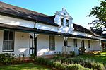 |
| 9/2/084/0106 | Bergh House, 11 Drostdy Street, Stellenbosch | The original portion of this building dates from the middle of the 18th century. It is now a typical example of a double-storeyed town house. The best known owner of the property was Prof. John Murray, one of the first two professors at the Theological Seminary. | Stellenbosch | Stellenbosch | İl Miras Alanı | 33°56′15″S 18 ° 51′48″ D / 33.937502°S 18.863430°E | 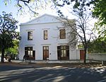 |
| 9/2/084/0107 | 110 Dorp Street, Stellenbosch | The original part of this double-storeyed town house dates from the beginning of the 19th century. The building was later adapted to the Georgian style. The property forms an essential part of the traditional architectural street scene of Dorp Street, and thus also of the historic core of Stellenbosch. | Stellenbosch | Stellenbosch | İl Miras Alanı | 33°56′20″S 18°51′26″E / 33.938886°S 18.857360°E | 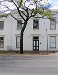 |
| 9/2/084/0108 | 108 Dorp Street, Stellenbosch | The original part of this historic house dates from the beginning of the 19th century and was later adapted to the Georgian style. It forms an integral part of the architecturally and historically important street scene of Dorp Street. | Stellenbosch | Stellenbosch | İl Miras Alanı | 33°56′21″S 18°51′26″E / 33.939098°S 18.857273°E | 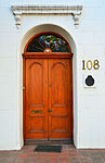 |
| 9/2/084/0109 | 112 Dorp Street, Stellenbosch | This historic house dates from approximately 1798 and was later converted to the Georgian style. It forms an integral part of the architecturally and historically important street scene of Dorp Street. | Stellenbosch | Stellenbosch | İl Miras Alanı | 33°56′21″S 18°51′28″E / 33.939233°S 18.857719°E |  |
| 9/2/084/0110 | 31 Van Riebeeck Street, Stellenbosch | This predominantly Victorian house dates from the beginning of the 20th century. Owing to the property's strategic position it forms an important aspect of the townscape. | Stellenbosch | Stellenbosch | İl Miras Alanı | 33 ° 56′12 ″ G 18 ° 52′06 ″ D / 33.936605°S 18.868412°E |  |
| 9/2/084/0111 | Oude Werf, 30 Church Street, Stellenbosch | This property initially formed the boundary of the original Stellenbosch cemetery which fell into disuse in 1710. In 1783 the plot came into the ownership of J. B. Hoffman, who was presumably responsible for the erection of the original Cape Dutch house. This building was thereafter used as a boarding-house for many decades. By 1889 an additional storey had been added, which gave the building its present imposing Georgian appearance. | Stellenbosch | Stellenbosch | İl Miras Alanı | 33 ° 56′17 ″ G 18°51′42″E / 33.937938°S 18.861780°E |  |
| 9/2/084/0112 | 149 Dorp Street, Stellenbosch | This house displays a harmonious mixture of Cape Dutch and Georgian characteristics. The oldest portion presumably dates from the beginning of the 18th century. The property forms an essential architectural and aesthetic keystone in the historic core of Stellenbosch. | Stellenbosch | Stellenbosch | İl Miras Alanı | 33°56′20″S 18 ° 51′43″ D / 33.9388°S 18.8619°E |  |
| 9/2/084/0113 | 141 and 143 Dorp Street, Stellenbosch | The original portions of this Cape Dutch house date from the middle of the 18th century and it was first used as parsonage for the Rev. Meent Borcherds. The property forms an essential part of the traditional architectural street scene of Dorp Street, and thus also of the historic core of Stellenbosch. | Stellenbosch | Stellenbosch | İl Miras Alanı | 33°56′20″S 18°51′40″E / 33.938790°S 18.860985°E |  |
| 9/2/084/0114 | Van Niekerk House, 47 Church Street, Stellenbosch | This double-storeyed Victorian house is situated on a plot which was granted to Landdrost C. Linnes as early as 1694. The building is closely associated with the historic core of Stellenbosch. | Stellenbosch | Stellenbosch | İl Miras Alanı | 33 ° 56′17 ″ G 18 ° 51′43″ D / 33.937920°S 18.861948°E |  |
| 9/2/084/0115 | Crozier House, 11 Victoria Street, Stellenbosch | The facade of this late 19th-century building has notable Victorian and Georgian characteristics. The Crozier House earlier formed part of the old College Square of the Victoria College. | Stellenbosch | Stellenbosch | İl Miras Alanı | 33°56′05″S 18°51′41″E / 33.934752°S 18.861476°E |  |
| 9/2/084/0116 | 25–35 Herte Street, Stellenbosch | This row of semi-detached cottages with their pointed gables was presumably erected during the middle of the 19th century as accommodation for freed slaves. These properties form an essential part of the historic and architectural character of Herte Street and also of the historic core of Stellenbosch. | Stellenbosch | Stellenbosch | İl Miras Alanı | 33 ° 56′17 ″ G 18°51′20″E / 33.938000°S 18.855562°E |  |
| 9/2/084/0117 | 126 Dorp Street, Stellenbosch | Stellenbosch | Stellenbosch | İl Miras Alanı | 33°56′20″S 18 ° 51′32″ D / 33.938847°S 18.858852°E |  | |
| 9/2/084/0119 | Hofmeyr Hall, 39 Church Street, Stellenbosch | This neo-classical hall, with its impressive Ionic temple facade, was inaugurated in October 1900. The building was constructed for use by the Christelijke Jongelieden Vereniging, and was named after Prof. N. J. Hofmeyr, founder of the Stellenbosch Seminary and the CJV. | Stellenbosch | Stellenbosch | İl Miras Alanı | 33 ° 56′16″ G 18°51′44″E / 33.937886°S 18.862112°E |  |
| 9/2/084/0120 | Old Conservatory, 10 Van Riebeeck Street, Stellenbosch | The South African Conservatorium of Music, the first conservatory in South Africa, was established in 1905, with Prof. F. W. Jannasch as Director. This double-storey building is built in an interesting mixture of architectural styles. | Stellenbosch | Stellenbosch | İl Miras Alanı | 33 ° 56′12 ″ G 18°51′55″E / 33.936797°S 18.865340°E |  |
| 9/2/084/0122 | Theological Seminary, 171 Dorp Street, Stellenbosch | The original Drostdy was the first public building in Stellenbosch and was a U-shaped building which was completely rebuilt, in 1763. It was then given an H-shape and the front of a traditional Cape Dutch farmhouse. It served as Drostdy until 1827. In 1859 the building was donated to the D.R. Church and the Theological Seminary was opened there. The building forms an integral part of the historic character of Dorp Street as well as of the historic core of Stellenbosch. | Stellenbosch | Stellenbosch | İl Miras Alanı | 33 ° 56′19″ G 18°51′51″E / 33.9386472222°S 18.8640361111°E |  |
| 9/2/084/0123 | 45 Dorp Street, Stellenbosch | This property originally formed part of the farm Vredenlust which was granted to Christoffel Henske in 1781. This cottage is one of a row of six similar semi-detached buildings which were erected between 1817and 1859 in the Cape Dutch style and which were later Victorianised. | Stellenbosch | Stellenbosch | İl Miras Alanı | 33°56′25″S 18 ° 51′15″ D / 33.940370°S 18.854041°E |  |
| 9/2/084/0124 | 1 Victoria Street, Stellenbosch | These three Victorianised semi-detached cottages were originally erected early in the 19th century. The cottages form an important architectural unit and lend character to the nearby College Square. | Stellenbosch | Stellenbosch | İl Miras Alanı | 33°56′05″S 18°51′39″E / 33.934607°S 18.860783°E |  |
| 9/2/084/0125 | 62–66 Andringa Street, Stellenbosch | Stellenbosch | Stellenbosch | İl Miras Alanı | 33°56′05″S 18°51′39″E / 33.934667°S 18.860733°E |  | |
| 9/2/084/0126 | Skuinshuis Jewish complex, 44 Ryneveld Street, Stellenbosch | The core of this double-storeyed building dates from about 1782. The facade of the house was rebuilt during the first half of the 19th century. The building, together with the historic chicken-coop, forms a unique architectural complex. | Stellenbosch | Stellenbosch | İl Miras Alanı | 33°56′09″S 18°51′46″E / 33.935862°S 18.862829°E |  |
| 9/2/084/0127 | 20 Crozier Street, Stellenbosch | This Victorian cottage forms part of a row of five semi-detached cottages that date from the late 19th century. | Stellenbosch | Stellenbosch | İl Miras Alanı | 33°55′59″S 18°51′39″E / 33.933052°S 18.860720°E |  |
| 9/2/084/0128 | 16 Crozier Street, Stellenbosch | This Victorian cottage forms part of a row of five semi-detached cottages that date from the late 19th century. | Stellenbosch | Stellenbosch | İl Miras Alanı | 33°55′59″S 18°51′38″E / 33.933192°S 18.860505°E |  |
| 9/2/084/0129 | De Eiken, 25 Market Street, Stellenbosch | This house was occupied from 1854 to 1898 by Carl Otto Hager, well-known church architect, photographer and painter. | Stellenbosch | Stellenbosch | İl Miras Alanı | 33 ° 56′19″ G 18°51′18″E / 33.938580°S 18.854910°E |  |
| 9/2/084/0131 | 14 Van Riebeeck Street, Stellenbosch | This late-Victorian house, with its exquisite cast-iron latticed veranda, dates from the 1890s. The property forms an important element in the townscape in view of its strategic position. | Stellenbosch | Stellenbosch | İl Miras Alanı | 33 ° 56′12 ″ G 18 ° 51′57 ″ D / 33.936738°S 18.865816°E |  |
| 9/2/084/0132 | Old C L Marais Library, Crozier Street, Stellenbosch | Thanks to a generous donation from a benefactor of Stellenbosch, Mr CL Marais, contributions from the Stellenbosch Distriksbank and the Colonial Government, the erection of a library building on the northern side of College Square was started in 1900 and completed in 1901. The new building was named after Mr CL Marais and was the first building in the history of the University which was built for this specific purpose. It did, however, also house the administrative offices of the Victoria College for approximately 20 years and some rooms in the building were used as Council Chambers and Senate committee rooms. | Stellenbosch | Stellenbosch | İl Miras Alanı | 33°56′00″S 18°51′38″E / 33.933420°S 18.860596°E |  |
| 9/2/084/0133 | Bergville, 13–15 Victoria Street, Stellenbosch | This predominantly Victorian building consists of two double-storeyed semi-detached houses which form an attractive architectural unit with a joint cornice and parapet wall. The building dates from the late 19th or early 20th century. | Stellenbosch | Stellenbosch | İl Miras Alanı | 33 ° 56′18″ G 18 ° 51′48″ D / 33.938284°S 18.863289°E |  |
| 9/2/084/0134 | Red House, 68 Kahler Street, Idas Valley, Stellenbosch | This impressive dwelling-house with its true Victorian features dates from the 19th century and is allegedly one of the oldest houses in the old Coloured area of ldasvallei. | Stellenbosch, Idas Valley | Stellenbosch | İl Miras Alanı | 33°55′14″S 18 ° 53′00″ D / 33.920527°S 18.883286°E |  |
| 9/2/084/0135 | Thaba 'Nchu, 5 Rattray Avenue, Stellenbosch | Thaba 'Nchu is a single storeyed semi-detached house in the high Victorian style, which was built in 1900 by James Rattray, the grandson of a British teacher brought over from England by Lord Charles Somerset. Thaba 'Nchu is not only a typical example of late Victorian houses erected in Stellenbosch at the turn of the century, but is also the only one of its kind which has been restored to its authentic colour scheme, an important feature being the simulated brick pattern of the outside walls. The walls are plastered with a raised narrow moulding applied in the first instance in a brickwork design and then painted black. From a distance the black lines against the ochre coloured plaster gives the impression that the wall is constructed of brick. The rustication is accentuated by white paint. The stoep is covered by a candy-striped curved corrugated-iron verandah, supported on cast-iron pillars which are decorated with delicate flower-and-leaves tracery. The section of the wall above the verandah and below the eaves has been painted white with black etchings, giving it a Tudor look. The large, gracefully curved, wooden end-gable was completely re-fashioned during restoration. | Stellenbosch | Stellenbosch | İl Miras Alanı | 33 ° 56′17 ″ G 18°52′02″E / 33.937979°S 18.867329°E |  |
| 9/2/084/0136 | 41 Dorp Street, Stellenbosch | These two Victorianised houses, which were originally erected during the first half of the 19th century, together with six other similar buildings, form one of the most charming and harmonious street scenes in Stellenbosch. | Stellenbosch | Stellenbosch | İl Miras Alanı | 33°56′25″S 18 ° 51′14″ D / 33.940373°S 18.853827°E |  |
| 9/2/084/0137 | 49 Dorp Street, Stellenbosch | These two semi-detached cottages form part of a row of eight similar semi-detached cottages that were erected between 1817 and 1859 in the Cape Dutch style and that were later Victorianised. The cottages form an important visual element of the historical character of Dorp Street in Stellenbosch. | Stellenbosch | Stellenbosch | İl Miras Alanı | 33°56′25″S 18 ° 51′15″ D / 33.940315°S 18.854264°E |  |
| 9/2/084/0138 | Caledon Villa, 7 Neethling Street, Stellenbosch | This impressive dwelling-house with its Edwardian and Victorian characteristics was erected in 1910 by the Rev. J. G. J. Krige of Caledon as a retirement home. | Stellenbosch | Stellenbosch | İl Miras Alanı | 33°56′15″S 18 ° 51′57 ″ D / 33.937513°S 18.865886°E |  |
| 9/2/084/0139 | 4 Neethling Street, Stellenbosch | This dwelling with its curved verandah and cast-iron decorations is one of two identical late-Victorian semi-detached houses that form an integral part of the architectural street scene of Neethling Street, as well as of the historical core of Stellenbosch. | Stellenbosch | Stellenbosch | İl Miras Alanı | 33 ° 56′17 ″ G 18 ° 52′00 ″ D / 33.938151°S 18.866739°E |  |
| 9/2/084/0140 | Nietgevonden, Stellenbosch District | Stellenbosch | Stellenbosch | Ulusal Anıt | 33°54′08″S 18°50′32″E / 33.902249°S 18.842152°E | | |
| 9/2/084/0142 | 26–30 Andringa Street, Stellenbosch | Stellenbosch | Stellenbosch | İl Miras Alanı | 33 ° 56′10″ G 18°51′39″E / 33.936162°S 18.860881°E |  | |
| 9/2/084/0143 | 162 Dorp Street, Stellenbosch | Stellenbosch | Stellenbosch | İl Miras Alanı | 33 ° 56′18″ G 18 ° 51′48″ D / 33.9384611111°S 18.8633277777°E |  | |
| 9/2/084/0144 | 13 Herte Street, Stellenbosch | Stellenbosch | Stellenbosch | İl Miras Alanı | 33°56′20″S 18 ° 51′21″ D / 33.938943°S 18.855832°E |  | |
| 9/2/084/0145 | 19 Herold Street, Stellenbosch | Stellenbosch | Stellenbosch | İl Miras Alanı | 33 ° 56′18″ G 18 ° 51′07 ″ D / 33.938415°S 18.851993°E |  | |
| 9/2/084/0146 | Old Labourers' Cottages, Aan-de-Wagen Road, Stellenbosch | These farm-hands' cottages date from the year 1902 and were probably designed by Sir Herbert Baker, the architect. | Stellenbosch | Stellenbosch | İl Miras Alanı | 33 ° 57′15 ″ G 18°51′20″E / 33.954133°S 18.855681°E |  |
| 9/2/084/0147 | Old Bloemhof Girls' Primary School, 52 Ryneveld Street, Stellenbosch | The building of the Bloemhof Girls' Primary School, which was opened on 2 June 1907, is an outstanding example of the eclectic style of building of the late 19th and early 20th centuries. Together with other historic buildings in Ryneveld Street it forms a unique historical and architectural group. | Stellenbosch | Stellenbosch | İl Miras Alanı | 33 ° 56′08″ G 18°51′46″E / 33.935654°S 18.862701°E | 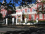 |
| 9/2/084/0148 | 37 Dorp Street, Stellenbosch | These two Victorianised houses, which were originally erected during the first half of the 19th century, together with six other similar buildings, form one of the most charming and harmonious street scenes in Stellenbosch. | Stellenbosch | Stellenbosch | İl Miras Alanı | 33°56′25″S 18°51′13″E / 33.940404°S 18.853602°E |  |
| 9/2/084/0149 | 39 Dorp Street, Stellenbosch | These two Victorianised houses, which were originally erected during the first half of the 19th century, together with six other similar buildings, form one of the most charming and harmonious street scenes in Stellenbosch. | Stellenbosch | Stellenbosch | İl Miras Alanı | 33°56′25″S 18°51′13″E / 33.940393°S 18.853725°E |  |
| 9/2/084/0150 | 18 Crozier Street, Stellenbosch | Stellenbosch | Stellenbosch | İl Miras Alanı | 33°55′59″S 18°51′38″E / 33.9331722222°S 18.8606222222°E |  | |
| 9/2/084/0151 | 22, 24 ve 26 Crozier Caddesi, Stellenbosch | Stellenbosch | Stellenbosch | İl Miras Alanı | 33 ° 56′00″ G 18 ° 51′39 ″ D / 33.933366 ° G 18.860777 ° D |  | |
| 9/2/084/0153 | Coopman Evi, 33 Kilise Sokağı, Stellenbosch | Bu tarihi konut, 18. yüzyılın ortalarına ait tipik bir Gürcü çift katlı şehir evidir. Tesis, Church Street'in geleneksel mimari sokak sahnesinin ve dolayısıyla Stellenbosch'un tarihi çekirdeğinin önemli bir bölümünü oluşturur. | Stellenbosch | Stellenbosch | İl Miras Alanı | 33 ° 56′17 ″ G 18 ° 51′43″ D / 33,938013 ° G 18,861963 ° D |  |
| 9/2/084/0154 | Ryneveldhof, Stellenbosch | Stellenbosch | Stellenbosch | İl Miras Alanı | 33 ° 55-55″ G 18 ° 51′43″ D / 33,931876 ° G 18,862083 ° D |  | |
| 9/2/084/0154/001 | 89 Banhoek Yolu, Stellenbosch | Ryneveldhof'un bir bölümü (Banhoek ve Ryneveld Caddelerinin köşesi) | Stellenbosch | Stellenbosch | İl Miras Alanı | 33 ° 55′48″ G 18 ° 51′56″ D / 33,930004 ° G 18,865622 ° D |  |
| 9/2/084/0154/002 | 91 Banhoek Yolu, Stellenbosch | Ryneveldhof'un bir bölümü (Banhoek ve Ryneveld Caddelerinin köşesi) | Stellenbosch | Stellenbosch | İl Miras Alanı | 33 ° 55′48″ G 18 ° 51′56″ D / 33,930004 ° G 18,865622 ° D | |
| 9/2/084/0154/003 | 93 Banhoek Yolu, Stellenbosch | Ryneveldhof'un bir bölümü (Banhoek ve Ryneveld Caddelerinin köşesi) | Stellenbosch | Stellenbosch | İl Miras Alanı | 33 ° 55′48″ G 18 ° 51′56″ D / 33,930004 ° G 18,865622 ° D | |
| 9/2/084/0154/004 | 83 Ryneveld Caddesi, Stellenbosch | Ryneveldhof'un parçası | Stellenbosch | Stellenbosch | İl Miras Alanı | 33 ° 56′00″ G 18 ° 51′44″ D / 33.933320 ° G 18.862157 ° D |  |
| 9/2/084/0154/005 | 81 Ryneveld Caddesi, Stellenbosch | Ryneveldhof'un parçası | Stellenbosch | Stellenbosch | İl Miras Alanı | 33 ° 56′00″ G 18 ° 51′44″ D / 33.933320 ° G 18.862157 ° D | |
| 9/2/084/0154/006 | 79 Ryneveld Caddesi, Stellenbosch | Ryneveldhof'un parçası | Stellenbosch | Stellenbosch | İl Miras Alanı | 33 ° 56′00″ G 18 ° 51′44″ D / 33.933320 ° G 18.862157 ° D |  |
| 9/2/084/0154/007 | 77 Ryneveld Caddesi, Stellenbosch | Ryneveldhof'un parçası | Stellenbosch | Stellenbosch | İl Miras Alanı | 33 ° 56′00″ G 18 ° 51′44″ D / 33.933320 ° G 18.862157 ° D | |
| 9/2/084/0154/008 | 75 Ryneveld Caddesi, Stellenbosch | Ryneveldhof'un parçası | Stellenbosch | Stellenbosch | İl Miras Alanı | 33 ° 56′00″ G 18 ° 51′44″ D / 33.933320 ° G 18.862157 ° D |  |
| 9/2/084/0154/009 | 73 Ryneveld Caddesi, Stellenbosch | Ryneveldhof'un parçası | Stellenbosch | Stellenbosch | İl Miras Alanı | 33 ° 56′00″ G 18 ° 51′44″ D / 33.933320 ° G 18.862157 ° D | |
| 9/2/084/0154/010 | 71 Ryneveld Caddesi, Stellenbosch | Stellenbosch | Stellenbosch | İl Miras Alanı | 33 ° 56′00″ G 18 ° 51′44″ D / 33.933320 ° G 18.862157 ° D |  | |
| 9/2/084/0154/011 | 69 Ryneveld Caddesi, Stellenbosch | Stellenbosch | Stellenbosch | İl Miras Alanı | 33 ° 56′00″ G 18 ° 51′44″ D / 33.933320 ° G 18.862157 ° D |  | |
| 9/2/084/0155 | 5 Ryneveld Caddesi, Stellenbosch | Stellenbosch | Stellenbosch | Ulusal Anıt | 33 ° 56′17 ″ G 18 ° 51′47″ D / 33.938141 ° G 18.863075 ° D | | |
| 9/2/084/0156 | Cloetesdal, Cloetesville, Stellenbosch | Stellenbosch | Stellenbosch | 33 ° 43′46″ G 18 ° 59′20″ D / 33.729440 ° G 18.988938 ° D | | ||
| 9/2/084/0157 | Spier, Stellenbosch Bölgesi | Stellenbosch | Stellenbosch | 33 ° 58′56 ″ G 18 ° 47′11″ D / 33.982209 ° G 18.786467 ° D | | ||
| 9/2/084/0158 | Morkel Evi, 4–6 Ryneveld Caddesi, Stellenbosch | Ryneveld Caddesi'nin doğu tarafında, Dorp Caddesi ile kesişmeden önceki ikinci son evi olan Morkel Evi, Güney Afrika'nın en eski yapı yapılarından biridir. Bu nedenle hem tarihsel hem de mimari açıdan büyük önem taşımaktadır. | Stellenbosch | Stellenbosch | İl Miras Alanı | 33 ° 56′17 ″ G 18 ° 51′47″ D / 33.937997 ° G 18.863027 ° D |  |
| 9/2/084/0159 | Compagnies Drift, Meerlust, Stellenbosch Bölgesi | Stellenbosch | Stellenbosch | Ulusal Anıt | | ||
| 9/2/084/0160 | Dagbreek Pansiyon, Victoria Caddesi, Stellenbosch | Stellenbosch | Stellenbosch | Bekleyen Beyan | 33 ° 55′58″ G 18 ° 52′09 ″ D / 33.932749 ° G 18.869089 ° D | | |
| 9/2/084/0161 | Morgenhof, Stellenbosch Bölgesi | Stellenbosch | Stellenbosch | Bekleyen Kayıt | 33 ° 53′38″ G 18 ° 51′39 ″ D / 33.893768 ° G 18.860878 ° D | | |
| 9/2/084/0163 | Oude Molen kompleksi, Stellenbosch | Stellenbosch | Stellenbosch | Ulusal Anıt | 33 ° 56′23″ G 18 ° 50′51″ D / 33.939747 ° G 18.847529 ° D | | |
| 9/2/084/0164 | Nyasa Evi, 13 Van Riebeeck Caddesi, Stellenbosch | Stellenbosch | Stellenbosch | 33 ° 56′13 ″ G 18 ° 51′57 ″ D / 33,937054 ° G 18,865742 ° D | | ||
| 9/2/084/0165 | Rozenhof, 8-18 Dorp Caddesi, Stellenbosch | Stellenbosch | Stellenbosch | 33 ° 56-26 ″ G 18 ° 51′00 ″ D / 33.940461 ° G 18.850100 ° D | | ||
| 9/2/084/0166 | STELLENBOSCH MAGISTERIAL DISTRICT, GENEL | Stellenbosch | Stellenbosch | | |||
| 9/2/084/0167 | Scholtzenhof, Stellenbosch Bölgesi | Stellenbosch | Stellenbosch | 34 ° 01′33″ G 18 ° 49′09 ″ D / 34.025866 ° G 18.819292 ° D | | ||
| 9/2/084/0168 | 6 Neethling Caddesi, Stellenbosch | Stellenbosch | Stellenbosch | 33 ° 56′17 ″ G 18 ° 52′00 ″ D / 33,938065 ° G 18,866713 ° D | | ||
| 9/2/084/0169 | Uitkyk, Stellenbosch Bölgesi | Stellenbosch | Stellenbosch | 33 ° 51′24″ G 18 ° 51′51″ D / 33.856607 ° G 18.864151 ° D | | ||
| 9/2/084/0170 | Bonfoi, Stellenbosch Bölgesi | Stellenbosch | Stellenbosch | 33 ° 56′30″ G 18 ° 46′32″ D / 33,941760 ° G 18,775447 ° D | | ||
| 9/2/084/0172 | 67 Ryneveld Caddesi, Stellenbosch | Stellenbosch | Stellenbosch | Ulusal Anıt | 33 ° 56′07 ″ G 18 ° 51′46″ D / 33,935258 ° G 18,862784 ° D | | |
| 9/2/084/0173 | 12 Neethling Caddesi, Stellenbosch | Stellenbosch | Stellenbosch | Ulusal Anıt | 33 ° 56′15 ″ G 18 ° 51′59″ D / 33.937444 ° G 18.866491 ° D | | |
| 9/2/084/0175 | Renish İlköğretim Okulu, 5 Bloem Caddesi, Stellenbosch | Stellenbosch | Stellenbosch | 33 ° 56′48″ G 18 ° 51′20″ D / 33.946720 ° G 18.855596 ° D | | ||
| 9/2/084/0176 | Graves, Welmoed Çiftlik, Stellenbosch Bölgesi | Stellenbosch | Stellenbosch | Ulusal Anıt | 33 ° 59′26 ″ G 18 ° 45′59″ D / 33.990592 ° G 18.766258 ° D | | |
| 9/2/084/0177 | Groene Rivier Ek B (Groenvlei), Çiftlik 570, Stellenbosch Bölgesi | Stellenbosch | Stellenbosch | | |||
| 9/2/084/0178 | 47 Dorp Caddesi, Stellenbosch Bölgesi | Stellenbosch | Stellenbosch | 33 ° 56′25″ G 18 ° 51′15″ D / 33.940334 ° G 18.854153 ° D | | ||
| 9/2/084/0179 | Welgevallen Arkeolojik Sit Alanı, Stellenbosch Bölgesi | Stellenbosch | Stellenbosch | | |||
| 9/2/084/0180 | Koloniesland, Stellenbosch | Stellenbosch | Stellenbosch | |
Stellenbosch kasabası yakınlarındaki miras alanları
| SAHRA tanımlayıcı | Site adı | Açıklama | Kasaba | İlçe | NHRA durumu | Koordinatlar | Resim |
|---|---|---|---|---|---|---|---|
| 9/2/083/0001 | Eski Hollanda Reform Kilisesi, Kilise Sokağı, Somerset West | Somerset West'teki eski Hollanda Reform Kilisesi, ana caddeden çok uzak olmayan Kilise ve Victoria Sokakları arasında yer almaktadır. Hottentots Holland cemaati, Somerset West kasabası kurulmadan üç yıl önce, 1819'da kuruldu. | Cape Town, Somerset West | Somerset West | İl Miras Alanı | 34 ° 05′12 ″ G 18 ° 50′47″ D / 34.086737 ° G 18.84633 ° D |  |
| 9/2/083/0002 | Parel Vallei, Aberdeen Yolu, Somerset West | Somerset West'in hemen yakınında, Boland'ın her sevgilisini nostaljiyle dolduran, Cape-Dutch çiftlikleriyle bir dizi eski tarihi çiftlik yatıyor. Bu çiftliklerden biri Parel Vallei.Parel Vallei Road, Som Mimari tarzındaki ana yoldan ayrılıyor: Cape Gabled, önemli katmanlarla. | Cape Town, Somerset West | Somerset West | İl Miras Alanı | 34 ° 04′02 ″ G 18 ° 51′19″ D / 34.067124 ° G 18.855244 ° D | |
| 9/2/083/0003 | Bridgewater Malikanesi, Somerset West | Somerset West | Somerset West | 34 ° 05′23 ″ G 18 ° 51′20″ D / 34.089732 ° G 18.855490 ° D | | ||
| 9/2/083/0004 | SOMERSET BATI BELEDİYE ALANI, GENEL | Somerset West | Somerset West | | |||
| 9/2/083/0005 | Helderberg Koleji Yolu: Ağaçların Bulvarı, Somerset West | Somerset West | Somerset West | 34 ° 03′38″ G 18 ° 50′16″ D / 34.060568 ° G 18.837649 ° D | | ||
| 9/2/083/0006 | Morgenster, Lourens Yolu, Somerset West Bölgesi | Ev, 6 gerçekten mükemmel kalkan ile H şeklindedir; ön üçgen (yakın zamanda yeniden inşa edilmiş) 1786 tarihli ve holbol stilini en güzel haliyle gösteriyor, dışbükey kenar pervazları üçgen yüzünde devam ediyor ve tamamen gelişmiş parşömenler olarak bitiyor, bu çiftliğin çekirdeği 4 bölümden üçüncüsünden oluşuyordu. Willem Adriaan van der Stel'in geri çağrılmasından sonra Vergelegen'in bölündüğü; Jacques Malan tarafından satın alındı. Malan’ın kızı Catharina, Onverwacht’dan Willem Morkel ve oğulları Mimari tarzı Cape Gabled ile evlendi. | Cape Town | Somerset West | İl Miras Alanı | 34 ° 04′42″ G 18 ° 52′01 ″ D / 34.078434 ° G 18.866819 ° D | |
| 9/2/083/0006/01 | Yukarı Morgenster, Çiftlik 1319'un geri kalanı, Morgenster, Somerset West | Somerset West | Somerset West | 34 ° 05′02 ″ G 18 ° 53′06 ″ D / 34,083949 ° G 18,884953 ° D | | ||
| 9/2/083/0007 | Gantouw Geçidi, Somerset West Bölgesi | Hottentots Holland Vadisi'nin Willem Adriaan van der Stel tarafından işgali, Koloninin doğuya doğru genişlemesini bir süreliğine durdurdu ve ancak 1707'de görevden alınmasından sonra Hottentots Holland Dağları üzerindeki yürüyüş başladı. Dik ve sarkık | Cape Town | Somerset West | İl Miras Alanı | 34 ° 08′21″ G 18 ° 56′25″ D / 34,139184 ° G 18,940279 ° D | 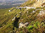 |
| 9/2/083/0008 | Voorburg, Victoria Caddesi, Somerset West | Mimari tarz: Cape Gabled.
| Cape Town, Somerset West | Somerset West | İl Miras Alanı | 34 ° 05′25″ G 18 ° 50′20″ D / 34.090319 ° G 18.838751 ° D | |
| 9/2/083/0009 | Zandvliet, Faure, Somerset West | Somerset West | Somerset West | | |||
| 9/2/083/0010 | Vergelegen, Somerset West | Somerset West | Somerset West | 34 ° 04′38″ G 18 ° 51′43″ D / 34.077178 ° G 18.861907 ° D |  | ||
| 9/2/083/0010/001 | Kafur ağaçları, Vergelegen, Somerset West | Tarihi Vergelegen çiftliği, Somerset West'in birkaç kilometre doğusunda, Hottentots Holland Dağları ile Helderberg arasında bir açıda yer almaktadır. Vali Willem Adriaan van der Stel'e konuk Komiser Wouter Valckenier tarafından verildi. | Cape Town, Somerset West | Somerset West | İl Miras Alanı | 34 ° 04′38″ G 18 ° 53′00″ D / 34.077174 ° G 18.883349 ° D | 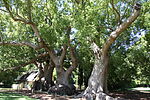 |
| 9/2/083/0011 | SIR LOWRY'NİN GEÇİŞ KÖYÜ, SOMERSET BATI BÖLGESİ, GENEL | Somerset West | Somerset West |  | |||
| 9/2/083/0011/001 | Tren İstasyonu, Sir Lowry's Pass Köyü | Site türü: Tren İstasyonu.
| Cape Town, Sir Lowry's Pass Köyü | Somerset West | İl Miras Alanı | 34 ° 07′05 ″ G 18 ° 54′47″ D / 34.118060 ° G 18.913060 ° D | |
| 9/2/083/0011/003 | Tatlı Safraan, Sir Lowry Geçidi Köyü, Somerset West Bölgesi | Orijinal konut, her iki tarafa açılan iki odadan oluşan merkezi bir geçitten oluşuyordu, bu da onu sazdan çatılı dört odalı bir ev haline getiriyordu. Daha sonraki bir tarihte, sağ tarafa doğrudan orijinalin dışına çıkan iki oda daha inşa edildi. t Bu konutun bulunduğu mülk, aslen 1779'da Köln'den CFPrenger'e verilen ve Frederiksburg olarak adlandırılan bir serbest mülkiyet ödeneğinin bir parçasıydı. 1830'da alt bölümlere ayrılmıştı ve bu kısım, kocası J.C'nin dul eşi J.C'nin elindeydi. | Cape Town, Sir Lowry Geçidi | Somerset West | İl Miras Alanı | 34 ° 07′08 ″ G 18 ° 54′33″ D / 34.118866 ° G 18.909053 ° D |  |
| 9/2/083/0011/2 | Eski İlköğretim Okulu, Sir Lowry's Pass Köyü, Somerset West Bölgesi | Somerset West | Somerset West | 34 ° 07′13 ″ G 18 ° 54′24″ D / 34,120283 ° G 18,906679 ° D | | ||
| 9/2/083/0012 | Predikants Meydanı, Somerset West | Site türü: Kamusal açık alan.
| Cape Town, Somerset West | Somerset West | İl Miras Alanı | 34 ° 05′03 ″ G 18 ° 50-29 ″ D / 34.084130 ° G 18.841370 ° D |  |
| 9/2/083/0013 | Eski Dovecot, Çiftlik 811, Overwacht (De Bosch / Die Bos), Somerset West District | Somerset West | Somerset West |  | |||
| 9/2/083/0013/001 | Eski Dovecot, Onverwacht 811, Somerset Batı Bölgesi | Yer türü: Dovecote Bu güvercinotu, genellikle eski çiftliklerde inşa edilen güvercinliklerin özellikle iyi bir örneğidir. | Cape Town | Somerset West | İl Miras Alanı | 33 ° 54′43″ G 18 ° 24′57″ D / 33.911847 ° G 18.415972 ° D | |
| 9/2/083/0014 | Dreamer's Tavern Coach Restaurant, 51 Victoria Yolu, Somerset West | Somerset West | Somerset West | 34 ° 05′10″ G 18 ° 50′48″ D / 34.086133 ° G 18.846557 ° D | | ||
| 9/2/083/0015 | Dennegeur, Somerset West | Somerset West | Somerset West | 34 ° 05′49 ″ G 18 ° 52′08″ D / 34.096887 ° G 18.868762 ° D | | ||
| 9/2/083/0016 | Eski Lourens Nehri Köprüsü, Ana Cadde, Somerset West | Strand ve Sir Lowry Geçidi'ne giden ana yolun Somerset West kasabasından ayrıldığı yerde bulunan bu köprü, Güney Afrika'daki iletişim tarihinde önemli bir olayı işaret ediyor.
| Cape Town, Somerset West | Somerset West | İl Miras Alanı | 34 ° 05′00 ″ G 18 ° 51′00 ″ D / 34.083242 ° G 18.849986 ° D |  |
| 9/2/083/0017 | Somerset House Hazırlık Okulu, Somerset West | Bu mülkün asıl satın alıcısı, çiftliğe Cloetenberg adını veren Gerrit Cloete'nin dul eşi Catherine idi. 1725'te Cloetenberg C.Louw'a devredildi ve Devir Tapusu, mülkteki bir eve kaydedilen ilk referansı içeriyor. | Cape Town, Somerset West | Somerset West | İl Miras Alanı | 34 ° 04′43 ″ G 18 ° 51′12 ″ D / 34.078643 ° G 18.853400 ° D | |
| 9/2/083/0018 | Land-en-Zeezicht, 15 Verster Caddesi, Somerset West | Land en-Zeezicht'teki çiftlik evi H şeklindedir; Evin şu anki arkasındaki ana ızgarası 1834 tarihli ve geç tarihinin işaretlerini gösteriyor: Kanatlı parşömenler orantısız büyürken İç pilasterler birbirine oldukça yakın. 1893'te Erinvale'li D. Buissini'nin yeğeni J. J. Hendriks'in mülkiyetine geçti. | Cape Town, Somerset West | Somerset West | İl Miras Alanı | 34 ° 04′19″ G 18 ° 52′32″ D / 34.072070 ° G 18.875487 ° D | |
| 9/2/083/0019 | Erinvale, Lourensford Yolu, Somerset West | Somerset West | Somerset West | 34 ° 04′24″ G 18 ° 53′18″ D / 34,073252 ° G 18,888292 ° D | | ||
| 9/2/083/0020 | Konut ve su değirmeni, Knorhoek, Somerset West District | Bu, birden fazla açıdan çok sıra dışı bir ev. Zemin planına göre, ev aslında H şeklindeydi ancak dikdörtgene çevrildi ve önünde bir çıkıntı ve arkasında arkadan öne uzanan üç paralel çıkıntı bulunan bir çatı ile örtüldü Knorhoek çiftliği 1717'de David Malan'a verildi ve De Fortuin ile birlikte 1790'da oğlu Jacques Malan'a ve bir yıl sonra 1795'te evi inşa eden François Joubert'e transfer edildi. | Cape Town | Somerset West | İl Miras Alanı | 33 ° 55′30″ G 18 ° 25′27″ D / 33.924869 ° G 18.424055 ° D | |
| 9/2/083/0021 | Eski Hollandalı Reform Kilisesi Papaz Evi, 41 Lourens Caddesi, Somerset West | 1819'da inşa edilen bu papaz evi binası, cemaate vekil olarak atanmasının ardından 1848'de Dr. J. F. Reitz'in isteği üzerine büyütülmüş ve gerçek Viktorya tarzında yeniden inşa edilmiştir. Bundan sonra 1948'e kadar papaz evi olarak hizmet etti. | Cape Town, Somerset West | Somerset West | İl Miras Alanı | 34 ° 05′18″ G 18 ° 50′51″ D / 34.088305 ° G 18.847575 ° D |  |
| 9/2/083/0022 | Lourens Caddesi, Somerset West | Somerset West | Somerset West | 34 ° 05′23″ G 18 ° 50′39″ D / 34.089695 ° G 18.844217 ° D | | ||
| 9/2/083/0023 | Polis Karakolu, 124 Ana Cadde, Somerset West | U şeklindeki bu yapı Hottentots Holland'a özgü bir özelliğe sahiptir; yani sadece kenar kalıbının genişliğine indirgenmiş küçük ayırt edici "baş parmak kanatlarına" sahip bir ön kalkan. Aslen bir mesken olan Polis Karakolu, muhtemelen 1835 Mimari tarzından kalmadır: Cape Gabled. | Cape Town, Somerset West | Somerset West | İl Miras Alanı | 34 ° 04′55 ″ G 18 ° 50′59″ D / 34.081862 ° G 18.849703 ° D | 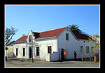 |
| 9/2/083/0024 | Sulh hakiminin ofisi, 126 Main Street, Somerset West | Mimari olarak mahkeme, yüzyılın başında kamusal yapı tarzının güzel bir örneğidir. Sütunlu ön cephenin her iki tarafında iki genişleme odası ve katmerleri vardır. Bu genişleyen cepheler alçak üçgen alınlıklara sahiptir ve Somerset West, 1892'de Bay J. St. 1898'de postaneyi de barındıran bir adliye binası tamamlandı.Somerset West, bu kez mimarlık üslubu haline geldi: Edward tarzı. | Cape Town, Somerset West | Somerset West | İl Miras Alanı | 34 ° 04′55 ″ G 18 ° 50′59″ D / 34.081857 ° G 18.849699 ° D |  |
| 9/2/083/0025 | Standart Banka Binası, Ana Cadde, Somerset West | Somerset West | Somerset West | 34 ° 05′08 ″ G 18 ° 51′10″ D / 34.085576 ° G 18.852866 ° D | | ||
| 9/2/083/0026 | Broadlands, Sir Lowry Geçidi, Somerset West Bölgesi | Somerset West | Somerset West | 34 ° 07′25″ G 18 ° 52′28″ D / 34,123501 ° G 18,874583 ° D | | ||
| 9/2/083/0027 | Quinan House, Somerset West Bölgesi | Somerset West | Somerset West | | |||
| 9/2/083/0028 | Groot Paardevlei, Somerset West | Somerset West'in eteklerinde eski Firgrove Yolu, Stellenbosch'a giden yoldan ayrılıyor. Birkaç kilometre ileride ve sağda Groot Paardevlei çiftliğine ait büyük bir bina grubu yer almaktadır. | Cape Town, Somerset West | Somerset West | İl Miras Alanı | 34 ° 05′20″ G 18 ° 49′56″ D / 34.088778 ° G 18.832240 ° D | |
| 9/2/083/0029 | Vergenoegd, Faure, Somerset West Bölgesi | Ev eksik bir H, sağ arka kanadı eksik; Ancak bu kanadın bir zamanlar var olduğu açıktır. Ön üçgen, Spier'deki müştemilatlardan biriyle aynıdır ve kenarı ile tamamen holbol çerçevesine sahip bir kalkanın güzel bir örneğidir.Eski sahiplerden biri olan Lambert Myburgh, bu evi inşa etmiş veya mevcut bir evi büyütmüş olabilir. Bu çiftlik ilk kez 1696'da Pieter de Vos'a verildi; Çeşitli transferlerden sonra Johannes Nicolaas Colyn'in malı oldu. | Cape Town | Somerset West | İl Miras Alanı | 34 ° 02′05 ″ G 18 ° 44′21″ D / 34.034606 ° G 18.739194 ° D |  |
| 9/2/083/0030 | Eski Kır Evi, 23 Andries Pretorius Caddesi, Somerset West | Somerset West | Somerset West | 34 ° 05′22 ″ G 18 ° 51′12 ″ D / 34.089405 ° G 18.853233 ° D | | ||
| 9/2/083/0032 | Marina Çiftliği, Almond Drive, Somerset West Bölgesi | Somerset West | Somerset West | | |||
| 9/2/083/0033 | Navarre, Firgrove, Somerset West Bölgesi | Navarre, H şeklinde küçük bir evdir ve bir arka kanat yeni bir eklentidir. Cape'in en güzel cephelerinden biri olan evin cephesinde, kapının her iki yanında birer tam genişlikte ve bir yarım genişlikte pencere vardır: pencereler kanatlı, küçük - sadece dört sıra | Cape Town, Firgrove | Somerset West | İl Miras Alanı | 34 ° 03′22″ G 18 ° 47′18″ D / 34.056188 ° G 18.788312 ° D | |
| 9/2/083/0034 | MACASSAR YEREL ALAN, GENEL | Somerset West | Somerset West | | |||
| 9/2/083/0035 | Şeyh Yusuf Kramat, Faure, Somerset West District | Somerset West | Somerset West | 34 ° 03′52″ G 18 ° 45-03 ″ D / 34.064384 ° G 18.750910 ° D | | ||
| 9/2/083/0036 | SOMERSET BATI BÜYÜCÜ BÖLGESİ (Croyden, Sir Lowry Geçidi, vb.) | Somerset West | Somerset West | | |||
| 9/2/083/0037 | AECI Sitesi, Somerset West | Somerset West | Somerset West | 34 ° 05′13 ″ G 18 ° 50′04 ″ D / 34.086916 ° G 18.834332 ° D |  | ||
| 9/2/083/0037/001 | Quinan Evi, Inner De Beers Caddesi, AECI, Somerset West | Evin her iki tarafında iki üçgen uçlu bir ön cephesi vardır. Çatı dik bir eğimlidir ve bu nedenle duvarlar yüksektir.Her uçta bir cumbalı pencere vardır. Sıva detayının özel olmamasına rağmen, cumbalı pencereler özel değildir. Rhodes, 1898'de De Beers'in kendi patlayıcılarını üretmesini önerdi. 1900'ün başlarında Stellenbosch Bölge Konseyi, De Beers Consolidated Mines Ltd'ye bir provi verdi. | Cape Town, AECI, Somerset West | Somerset West | İl Miras Alanı | 34 ° 05′00 ″ G 18 ° 51′00 ″ D / 34.083333 ° G 18.850000 ° D | |
| 9/2/083/0038 | Fleur Du Cap, Lourensford Yolu, Somerset West | Somerset West | Somerset West | | |||
| 9/2/083/0039 | San Gabriel Çiftliği, Çiftlik 583, Somerset West Bölgesi | Paul Hartog, jr'a 1759'da verildi ve 2 morgen boyutundaydı. Evi 3 yıl önce inşa etmişti. En eski tipte basit bir holbol ızgarası var; Joostenburg'unki ile birlikte, hayatta kalan en eski 2 duvardan biridir - her ikisi de inşa edilmiştir | Cape Town | Somerset West | Kayıt ol | 33 ° 55′30″ G 18 ° 25′27″ D / 33.924869 ° G 18.424055 ° D | |
| 9/2/083/0040 | Metodist Misyon Kilisesi, Somerset West | Somerset West | Somerset West | 34 ° 05′09 ″ G 18 ° 50′58″ D / 34.085913 ° G 18.849460 ° D |  | ||
| 9/2/083/0040/001 | Coachman's Cottage, 23 Andries Pretorius Street, Somerset West | The Coachman’s Cottage, 1830'larda Wesleyan Kilisesi arazisinde azat edilmiş köleler tarafından inşa edilen birkaç kır evinden biriydi. Arazi hala Metodist Kilisesi'ne aitken, evler sürekli kira kontratıyla sahiplerine aittir. | Cape Town, Somerset West | Somerset West | İl Miras Alanı | 34 ° 05′22 ″ G 18 ° 51′12 ″ D / 34.089394 ° G 18.853243 ° D |  |
| 9/2/083/0041 | Bredell Evi, Helderberg Köyü, Bredell Yolu, Somerset West Bölgesi | Bu Viktorya dönemi çiftlik evi, mimari karakterini ve orijinal doğramalarının çoğunu koruduğu için bölgeye katkıda bulunmaktadır. Modern bir gelişimin girişindeki konumu, bu kökene sahip olmanın önemine katkıda bulunur. | Cape Town | Somerset West | Kayıt ol | 34 ° 02′45″ G 18 ° 48′45″ D / 34.045735 ° G 18.812603 ° D | |
| 9/2/083/0042 | Lwandle Pansiyon, Somerset West Dist | Somerset West | Somerset West | | |||
| 9/2/083/0043 | Lourensford Estate, Lourensford Road, Erf 471, Somerset West | Somerset West | Somerset West | 34 ° 04′19″ G 18 ° 53′19″ D / 34.071897 ° G 18.888705 ° D | | ||
| 9/2/084/0002 | Idas Vadisi, Cape Winelands Kültürel Peyzajı | CWCL, pastoral konumu, yaşayan mirasla ilişkili zengin tarihi ve kendine özgü kültürel ve doğal çevresi nedeniyle önemlidir; Güney Afrika'ya özgü mimari ve estetik bir forma sahip benzersiz planlı peyzajlar. Büyük önem taşıyan, Güney Afrika'daki kölelik tarihi ile ilgili olarak önemli bir yer. İdaş Vadisi, bu kültürel peyzaj türünün tipik ve aynı zamanda özel bir örneğidir. Genel olarak Cape Winelands bağlamında özellikle bozulmamış. | Stellenbosch | Ulusal Miras Alanı | 33 ° 52′59″ G 18 ° 56′14″ D / 33.883020 ° G 18.937168 ° D |  | |
| 9/2/084/0002/001 | Kelsey Çiftliği, Idas Vadisi, Stellenbosch Bölgesi | Stellenbosch | İl Miras Alanı | 33 ° 54′52″ G 18 ° 54′03 ″ D / 33.914533 ° G 18.900819 ° D | | ||
| 9/2/084/0002/002 | Kama Çiftliği, Idas Vadisi, Stellenbosch Bölgesi | Stellenbosch | İl Miras Alanı | 33 ° 55′00″ G 18 ° 54′14″ D / 33.916670 ° G 18.903823 ° D | | ||
| 9/2/084/0002/003 | Ida Minor, Idas Vadisi, Stellenbosch Bölgesi | Stellenbosch | İl Miras Alanı | 33 ° 54′52″ G 18 ° 53′58″ D / 33.914533 ° G 18.899360 ° D | | ||
| 9/2/084/0002/004 | Hymettus Çiftliği, Idas Vadisi, Stellenbosch Bölgesi | Stellenbosch | İl Miras Alanı | 33 ° 55′02 ″ G 18 ° 52′26″ D / 33.917311 ° G 18.873782 ° D | | ||
| 9/2/084/0002/005 | Idas Vadisi Çiftliği, Idas Vadisi, Stellenbosch Bölgesi | Stellenbosch | İl Miras Alanı | 33 ° 55′22″ G 18 ° 53′14″ D / 33.922653 ° G 18.887258 ° D |  | ||
| 9/2/084/0002/006 | Heather Tepesi, Idas Vadisi, Stellenbosch Bölgesi | Stellenbosch | İl Miras Alanı | 33 ° 54′55″ G 18 ° 53′53″ D / 33.915174 ° G 18.897986 ° D | | ||
| 9/2/084/0002/007 | Glenbawn, Idas Vadisi, Stellenbosch Bölgesi | Stellenbosch | İl Miras Alanı | 33 ° 55′21″ G 18 ° 53′08″ D / 33,922581 ° G 18,885455 ° D | | ||
| 9/2/084/0002/008 | Yüksek Rustenburg, Idas Vadisi, Stellenbosch Bölgesi | Stellenbosch | İl Miras Alanı | 33 ° 55′19″ G 18 ° 53′09 ″ D / 33,922083 ° G 18,885713 ° D | | ||
| 9/2/084/0002/009 | Rustenburg, Idas Vadisi, Stellenbosch Bölgesi | Stellenbosch | İl Miras Alanı | 33 ° 55′22″ G 18 ° 53′08″ D / 33,922866 ° G 18,885455 ° D | | ||
| 9/2/084/0002/010 | Schoongezicht, Idas Vadisi, Stellenbosch Bölgesi | Stellenbosch | İl Miras Alanı | 33 ° 55′20″ G 18 ° 53′11″ D / 33.922289 ° G 18.886378 ° D |  | ||
| 9/2/084/0002/011 | Heather Kır Evi, Idas Vadisi, Stellenbosch Bölgesi | Stellenbosch | İl Miras Alanı | 33 ° 55′21″ G 18 ° 53′03 ″ D / 33.922368 ° G 18.884082 ° D | | ||
| 9/2/084/0002/012 | Volksrust, Idas Vadisi, Stellenbosch Bölgesi | Idas Vadisi'ndeki ilk çiftlik, 1683'te bir Fransız Huguenot olan François Villon'a verildi. J. X. Merriman ve Sir Thomas Smartt gibi önemli tarihi şahsiyetler de Valley'de çiftliklere sahipti. Birkaç çiftlikte, özellikle Rustenburg, Schoongezicht, Idas Valley ve Glenbawn'da, önemli mimari öneme sahip Cape Dutch evleri ve şarap mahzenleri bulunmaktadır. Vadi aynı zamanda benzersiz bir rustik karaktere ve doğal güzelliğe sahiptir ve bütünüyle olağanüstü ulusal öneme sahiptir. | Stellenbosch | İl Miras Alanı | 33 ° 55′22″ G 18 ° 53′11″ D / 33.922795 ° G 18.886485 ° D | | |
| 9/2/084/0002/013 | Entabeni, Idas Vadisi, Stellenbosch Bölgesi | Stellenbosch | İl Miras Alanı | 33 ° 55′21″ G 18 ° 53′16″ D / 33.922628 ° G 18.887730 ° D | | ||
| 9/2/084/0002/014 | Eski Meyve Bahçesi, Idas Vadisi, Stellenbosch Bölgesi | Stellenbosch | İl Miras Alanı | 33 ° 55′21″ G 18 ° 53′10″ D / 33,922581 ° G 18,886056 ° D | | ||
| 9/2/084/0002/015 | Kama Köşesi, Idas Vadisi, Stellenbosch Bölgesi | Stellenbosch | İl Miras Alanı | 33 ° 55′21″ G 18 ° 53′10″ D / 33.922628 ° G 18.886013 ° D | | ||
| 9/2/084/0002/016 | Simonsberg, Idas Vadisi, Stellenbosch Bölgesi | Stellenbosch | İl Miras Alanı | 33 ° 55′25″ G 18 ° 53′10″ D / 33.923483 ° G 18.886013 ° D | | ||
| 9/2/084/0002/017 | Cranford, Idas Vadisi, Stellenbosch Bölgesi | Stellenbosch | İl Miras Alanı | 33 ° 55′20″ G 18 ° 53′15″ D / 33.922343 ° G 18.887386 ° D | | ||
| 9/2/084/0002/018 | Wedgewood Çiftliği, Idas Vadisi, Stellenbosch Bölgesi | Stellenbosch | İl Miras Alanı | 33 ° 55′22″ G 18 ° 53′12″ D / 33.922739 ° G 18.886786 ° D | | ||
| 9/2/084/0002/019 | Wedgewood, Idas Vadisi, Stellenbosch Bölgesi | Stellenbosch | İl Miras Alanı | 33 ° 55′24″ G 18 ° 53′16″ D / 33.923198 ° G 18.887730 ° D | | ||
| 9/2/084/0002/020 | Heather Tepesi, Idas Vadisi, Stellenbosch Bölgesi'nin bir parçası | Stellenbosch | İl Miras Alanı | 33 ° 55′25″ G 18 ° 52′49″ D / 33,923483 ° G 18,880177 ° D | | ||
| 9/2/084/0002/021 | Idas Vadisi'nin bir parçası, Idas Vadisi, Stellenbosch Bölgesi | Stellenbosch | İl Miras Alanı | 33 ° 55′20″ G 18 ° 53′09 ″ D / 33.922212 ° G 18.885772 ° D | | ||
| 9/2/084/0006 | Bellevue, Stellenbosch Bölgesi | Houd den Mond çiftliği olarak bilinen, Bellevue Malikanesi'nin tarihi çiftliğinin bulunduğu tesis. | Stellenbosch | İl Miras Alanı | 33 ° 59′01 ″ G 18 ° 50′09 ″ D / 33.983528 ° G 18.835773 ° D | | |
| 9/2/084/0008 | Elsenburg, Stellenbosch Bölgesi | Elsenburg çiftliğinin bir bölümünde yer alan tarihi bina ve yapıları da içeren tarihi çiftlik avlusu. | Stellenbosch | İl Miras Alanı | 33 ° 56′02 ″ G 18 ° 51′48″ D / 33,933826 ° G 18,863332 ° D |  | |
| 9/2/084/0020 | Rust en Vrede, Annandale Yolu, Stellenbosch | Rust en Vrede şarap arazisinin tarihi evi ve şarap mahzeni. | Stellenbosch | İl Miras Alanı | 33 ° 59′51″ G 18 ° 51′08 ″ D / 33.997415 ° G 18.852137 ° D |  | |
| 9/2/084/0022/001 | Klein Gustrouw, Jonkershoek, Stellenbosch Bölgesi | Aslen özgür bir köle olan Louis van Bengallen'e 1683'te verildi. 1696'da öldüğünde, Angola'lı Anthony'nin malikanesine geçti. | Stellenbosch | İl Miras Alanı | 33 ° 57′20″ G 19 ° 00′36 ″ D / 33.955446 ° G 19.010124 ° D | | |
| 9/2/084/0022/002 | Leef op Hoop, Jonkershoek, Stellenbosch Bölgesi | Bu etkileyici H şeklindeki konut, 19. yüzyılın başlarından kalmadır. Gürcü ve Viktorya dönemi özelliklerine sahiptir ve hem orijinal çiftlik hem de konutun ikiye bölünmesi bakımından benzersizdir. | Stellenbosch | İl Miras Alanı | 33 ° 55′57 ″ G 19 ° 00′48″ D / 33.932465 ° G 19.013214 ° D | | |
| 9/2/084/0025 | Eski Nektar, Glenconnor Çiftliği, Jonkershoek, Stellenbosch Bölgesi | Eski Nektar, mimari olarak eski Cape tipinin en iyi ve en iyi bilinen üçgen evlerinden biridir. Bu evin ön cephesi, geç neo-klasik tipteki üçgen kalkanın olağanüstü bir örneği olan Western Cape'deki en çarpıcılardan biridir. Üçgen duvarın etkileyici görünümü, yüksekliğin mükemmel oranlarının yanı sıra kalkanın benzersiz tasarımından kaynaklanmaktadır. Üçgen, dar cephenin tam olarak üçte birini kaplar, bu da ona yükseklik ve önem kazandıran bir durumdur. Denge, kapının her iki tarafındaki tam genişlikte ve yarım genişlikte bir pencere ve üzerinde tam genişlikte bir çatı penceresi ile korunur. Öndeki sabit kapı ve fan ışığı kanatlı pencereler, küçük camlar ve ahşap panjurlarla birlikte uyumlu bir bütün oluşturur. Üçgen, kendine özgü karakterini, basamaktan, her bir pilasterin üzerindeki vazodan ve üçgen alınlıktan kesintisiz olarak yükselen dört pilastradan alır. Pilasterler arasındaki düz sıvalı boşlukların monotonluğu festonlarla kırılmıştır. | Stellenbosch | İl Miras Alanı | 33 ° 54′18″ G 19 ° 00′18″ D / 33.905115°S 19.004974°E | | |
| 9/2/084/0026 | Fleurbaix Farmstead, Stellenbosch District | This farm was granted in 1695 to a Huguenot, Pierre le Fèbre, who was a surgeon by profession. Named after the town of Fleurbaix in Picardie, the farm was over 44 morgen in size. The house is said to date from 1768; the end-gables and the front gable were added in 1800, during the ownership of Paul Roux. The plan of the house, points to it having grown in stages. The house is H-shaped, but a wall (in which there is an 18c wall-cupboard flanked by doors) separates the voorhuis (which is deeper than the adjoining rooms) from the agterkamer. This is usual in a house that was once T-shaped. There is a flat-roofed addition to the right-hand back wing. The front gable is of a transitional type, with holbol characteristics as well as a small pediment; the end-gables also have pediments, with unusual undulating outlines. There is no back gable, which supports the theory that the front and end-gables are later additions. Most original ceilings and many doors survive, but the external woodwork is 19th century. The thatch had been replaced by corrugated iron with raised eaves level. Flanking the house, and in line with it, are outbuildings with iron roofs and plain holbol end-gables. | Stellenbosch | İl Miras Alanı | 33 ° 54′48″ G 18°45′39″E / 33.913289°S 18.760872°E | | |
| 9/2/084/0032 | Neethlingshof, Stellenbosch District | This property was originally granted to Barend Lubbe in 1699. The present H-shaped gabled house with its impressive facade was erected in 1814 by Charles Marais. | Stellenbosch | İl Miras Alanı | 33 ° 56′15 ″ G 18°51′58″E / 33.937407°S 18.866224°E | 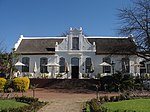 | |
| 9/2/084/0033 | Nooitgedacht, Stellenbosch District | About nine km from Stellenbosch along the road to Koelenhof a farm road turns off sharply to the right, crosses a bridge and enters a white-washed gateway heavily shadowed by oaks. Behind these trees stands the fine old house of Nooitgedacht. The house was built in 1774, and is an outstanding example of Cape Dutch architecture. Together with the slave bell and the outbuildings which include the wine cellar, it forms a remarkable architectural complex. The farm is also of special importance in the history of pomology in the Western Province. | Stellenbosch | İl Miras Alanı | 33°57′06″S 18°51′51″E / 33.951701°S 18.864217°E | | |
| 9/2/084/0087 | Uiterwyk, Stellenbosch District | This property was granted in 1699 to Dirk Coetzee. In 1791 Johannes Krige enlarged the existing house and added gables. This Cape Dutch house is at present H-shaped, with an impressive concavo-convex front gable. | Stellenbosch | İl Miras Alanı | 33 ° 55-50″ G 18°53′08″E / 33.930558°S 18.885455°E | | |
| 9/2/084/0088 | Koopmanskloof, Stellenbosch District | This Cape Dutch house was erected in 1801 by Petrus Johannes Bosman. The unusual double T-shaped ground plan, the stepped gables on the sides and the authentic Malay plaster-work are of particular architectural interest. | Stellenbosch | İl Miras Alanı | 33°54′02″S 18°46′14″E / 33.900422°S 18.770491°E |  | |
| 9/2/084/0089 | Vredenburg, Stellenbosch District | The farm Vredenburg was granted to Hendrik Elbertz in 1691. The historic dwelling thereon was built by a later owner, Jacob Roux, in 1789. | Stellenbosch | İl Miras Alanı | 33 ° 57′40″ G 18 ° 48′25″ D / 33.961026°S 18.806999°E |  | |
| 9/2/084/0101 | Weltevreden, Stellenbosch District | The property known as the Weltevreden farm, including all the historical buildings thereon. This H-shaped Cape Dutch dwelling-house has six elaborately finished gables. The front gable bears the date 1812. The wine-cellar was built in approximately 1804 and, together with the farm house and outbuildings, forms an important architectural complex. | Stellenbosch | İl Miras Alanı | 33 ° 53′57 ″ G 18 ° 50′52″ D / 33.899188°S 18.847872°E |  | |
| 9/2/084/0118 | Libertas, Stellenbosch District | Home of Adam Tas. Originally granted to Jan Cornelisz, it was purchased by Jurgen Grimpen a German. Grimpen's widow married Adam Tas and hence the Tas connection. Adam Tas procured the farm in 1702 and lived here until his death in 1722. Especially noteworthy of this Cape Dutch building complex, is the H-shaped main dwelling-house with its frescos by Jan Adam Hoffman (This is incorrect. The frescos were in fact painted by the artist/schoolteacher Jan Adam Hartman who was in the employ of the well-to-do Hoffman family -ref. http://www.stellenboschwriters.com/hmlibertas.html ) in 1779. | Stellenbosch | İl Miras Alanı | 33°55′55″S 18 ° 51′42″ D / 33.931855°S 18.861551°E | 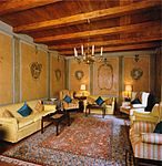 | |
| 9/2/084/0130 | Champagne, Stellenbosch District | The farm Dwars-in-den-Weg, now known as Champagne, was granted to Jacob de Wilde in 1697. The Cape Dutch dwelling-house was presumably erected in 1793 by Isaac Stephanus de Villiers. The house is T-shaped it has been thoroughly modernized, internally as well as externally. But it retains a most interesting gable of the transitional period, with outline mouldings reminiscent of the holbol gables but with short pilasters on its face and a pediment (cf. those of Eenzaamheid and Welmoed). | Stellenbosch | İl Miras Alanı | 33°58′23″S 18°51′12″E / 33.973159°S 18.853223°E | | |
| 9/2/084/0140-001 | Lime kiln, Nietgevonden, Stellenbosch District | This unique lime kiln was presumably erected by Hermanus Johannes van Brakel shortly after the subdivision of the farm Rustenburg in 1790 of which Nietgegund (now known as Stellenkloof) also originally formed part. It is the only structure of its kind in the Stellenbosch district. | Stellenbosch | İl Miras Alanı | 33°55′54″S 18°51′51″E / 33.931744°S 18.864040°E | | |
| 9/2/084/0141 | By-Den-Weg, Stellenbosch District | Stellenbosch | İl Miras Alanı | 33 ° 56′34″ G 18°47′16″E / 33.942687°S 18.787876°E | | ||
| 9/2/084/0162 | Trout hatchery, Assegaaibosch, Jonkershoek, Stellenbosch District | Stellenbosch | İl Miras Alanı | 33 ° 55′40″ G 19°00′38″E / 33.927907°S 19.010468°E |  | ||
| 9/2/084/0171 | Meerlust, Stellenbosch District | One of the first farmers to be granted land beyond the confines of the Cape Peninsula in about 1680, was Henning Husing, a large-scale cattle farmer who for many years enjoyed the monopoly of supplying meat to the Dutch East India Company. His farm, which he called Meerlust, was situated on the Eerste River, a short distance north of where Faure is today. Not only did it become one of the most important historical farms in the area, but the fine gabled house which was recently restored by the owner remains an outstanding example of Cape Dutch architecture. | Stellenbosch | İl Miras Alanı | 33 ° 55′48″ G 18 ° 51′31″ D / 33.929937°S 18.858719°E |  | |
| 9/2/084/0171/001 | Dovecot, Meerlust, Stellenbosch District | Such dovecots were typical features of many old Cape farms and they were carefully designed. In fact, just as much attention was given to their facades as to those of the main dwellings, which explains why they have considerable architectural and aesthetic merits. The one at Meerlust is one of the best preserved examples in the Western Province. | Stellenbosch | İl Miras Alanı | 33 ° 55′40″ G 18 ° 53′03 ″ D / 33.927907°S 18.884125°E |  | |
| 9/2/089/0001 | STRAND MUNICIPAL AREA, GENERAL | İplik | Stellenbosch | | |||
| 9/2/089/0002 | Post Office, Beach Road, Gordon's Bay | Site türü: Postane.
| Cape Town, Gordon's Bay | İplik | Kayıt ol | 34°09′45″S 18°51′52″E / 34.162496°S 18.864558°E |  |
| 9/2/089/0003 | Police Station, Beach Road, Gordon's Bay | Site türü: Polis Karakolu.
| Cape Town, Gordon's Bay | İplik | Kayıt ol | 34°09′45″S 18°51′52″E / 34.162496°S 18.864558°E |  |
| 9/2/089/0004 | Old Synagogue, Westley Street, Strand | İplik | Stellenbosch | | |||
| 9/2/089/0005 | GORDONS BAY MUNICIPAL AREA, STRAND DISTRICT, GENERAL | Gordon Körfezi | Stellenbosch | |
Ayrıca bakınız
Referanslar
- ^ "Western Cape Eyalet Miras Alanları (önceden Ulusal Anıtlar)" (PDF). Western Cape Hükümeti. 19 Eylül 2002. Alındı 3 Eylül 2013.
Dış bağlantılar
The South African Heritage Resources Information System – Declared Sites
Güney Afrika Miras Kaynakları Listesi | ||||||||||||||||||||
|---|---|---|---|---|---|---|---|---|---|---|---|---|---|---|---|---|---|---|---|---|
| SAHRA Miras alanları |
| |||||||||||||||||||
| Dünya Miras bölgeleri | ||||||||||||||||||||