Merkez tren istasyonu, Sidney - Central railway station, Sydney - Wikipedia
Merkez | |
|---|---|
 2017'de resmedilen merkez tren istasyonu | |
| yer | Eddy Caddesi, Sydney NSW Avustralya |
| Koordinatlar | 33 ° 53′06 ″ G 151 ° 12′19 ″ D / 33.8849 ° G 151.2052 ° DKoordinatlar: 33 ° 53′06 ″ G 151 ° 12′19 ″ D / 33.8849 ° G 151.2052 ° D |
| Yükseklik | 20 metre (67 ft) |
| Tarafından sahip olunan | Taşıma Varlık Holding Varlığı |
| Platformlar | 25
|
| Tren operatörleri | |
| Bağlantılar |
|
| İnşaat | |
| Yapı türü | Yer ve yeraltı |
| Engelli erişim | Evet |
| Diğer bilgiler | |
| Durum | Kadrolu (24 saat, 7 gün / hafta) |
| İnternet sitesi | TransportNSW bilgilerindeki merkez istasyon |
| Tarih | |
| Açıldı | 5 Ağustos 1906 |
| Elektrikli | Evet |
| Yolcular | |
| 2018 | 85,4 milyon 233,970 (günlük)[1] |
| Sıra | 1 |
Bina ayrıntıları | |
 | |
| Genel bilgi | |
| Durum | Tamamlayınız |
| Tür | Tren istasyonu son |
| Mimari tarz | Federasyonsuz Klasik |
| Tamamlandı | 1906 |
| Açılışını yapmak | 4 Ağustos 1906 |
| Yenilenmiş | 1979 Ocak 1915 |
| Müşteri | Yeni Güney Galler Devlet Demiryolları |
| Yükseklik | |
| İpucu | 85,6 metre (281 ft) AHD |
| Teknik detaylar | |
| Malzeme |
|
| tasarım ve yapım | |
| Mimar | Walter Liberty Vernon (1901-06) |
| Mimarlık firması | Yeni Güney Galler Hükümeti Mimarı |
| Geliştirici | Yeni Güney Galler Hükümeti |
| Mühendis | Henry Deane (Yeni Güney Galler Devlet Demiryolları Baş Mühendisi) |
| Servis mühendisi | John Bradfield (demiryolu mühendisliği) |
| Diğer tasarımcılar | Fairfax ve Roberts (Saat kulesi ) |
| Ana müteahhit | NSW Bayındırlık İşleri Bakanlığı |
| Resmi ad | Sidney Terminali ve Merkez Tren İstasyonları Grubu; Merkez Demiryolu; Merkezi istasyon; Köprü altı |
| Tür | Devlet mirası (karmaşık / grup) |
| Kriterler | a., b., c., d., e., f., g. |
| Belirlenmiş | 2 Nisan 1999 |
| Referans Numarası. | 1255 |
| Tür | Demiryolu Platformu / İstasyonu |
| Kategori | Taşıma - Raylı |
| Referanslar | |
| [2][3][4][5][6] | |
Merkez miras listesinde yer alan bir Avustralyalı tren istasyonu merkezinde bulunan Sydney içinde Sidney Şehri yerel yönetim bölgesi Yeni Güney Galler. İstasyon, Yeni Güney Galler'deki en büyük ve en yoğun tren istasyonudur ve önemli bir ulaşım kavşağı için NSW TrainLink şehirlerarası demiryolu Hizmetler, Sidney Trenleri banliyö treni Hizmetler, Sydney hafif raylı sistemi Hizmetler, Eyalet Transit ve özel otobüs hizmetleri ve özel otobüsle ulaşım hizmetleri. İstasyon aynı zamanda Sidney Terminali (özellikle eski, şehirlerarası bölüm). Mülk, Yeni Güney Galler Eyalet Miras Kaydı 2 Nisan 1999.[2] 2018'de 85,4 milyon yolcu hareketi kaydetti.
Merkez istasyon ayıran büyük bir şehir bloğunu kaplar Haymarket, Surry Tepeleri ve merkezi ticaret bölgesi, Demiryolu Meydanı ve Pitt Caddesi batıda, Eddy Caddesi Kuzeyde, Elizabeth Caddesi doğuda ve Devonshire Caddesi Tüneli güneyde. İstasyonun bölümleri ve Marshalling yardaları güneye kadar uzanmak Cleveland Caddesi ve eski sitenin sitesinde bulunur Devonshire Street Mezarlığı.
Tarih

İlk Sidney terminali
Sidney'de üç terminal istasyonu var.
Demiryolu 1831'de New South Wales'e ulaştı. Demiryolu bağlantısı için teklifler 1840'larda başladı. Sydney ve Parramatta Sidney şehir merkezine yakın bir doğu terminali ile.
Sidney Demiryolu Şirketi ilk olarak Hay ile arasındaki dört blokluk arazi için hükümete başvurdu. Cleveland 1849'da sokaklarda genel anketör Grose Farm'ı tercih etti, şimdi Sydney Üniversitesi. Şehirden uzaktı ve geliştirilmesi daha az maliyetliydi. Şirket nihayet, Devonshire ve Cleveland Sokakları arasındaki dördüncü blokta, Hükümet Padokları'nda sekiz hektarlık (yirmi dönüm) artırılmış bir alan için Hay ve Devonshire sokakları arasındaki birinci, ikinci ve üçüncü blokta arazi takas etti. Bu nedenle, ilk Sidney demiryolu terminalinin yeri 1855'ten itibaren burada bulunuyordu.[2]
Orijinal Sidney istasyonu 26 Eylül 1855'te Cleveland Fields olarak bilinen bir bölgede açıldı. Yolcu trenleri için Parramatta'ya giden hattın açılması zamanında Ağustos sonundan Eylül 1855'e kadar hızla inşa edilen geçici bir ahşap ve oluklu demir binaydı.[2]
Sydney Terminali adı verilen bu istasyon (oluklu demirden bir barakada bir ahşap platform) kuzey sınırı olarak Devonshire Caddesi'ne sahipti.[5] Sık sık ama gayri resmi olarak Redfern istasyonu deniyordu.[7] o sırada şimdiki zaman Redfern istasyonu resmen Eveleigh olarak adlandırıldı.[8] "Redfern İstasyonu" olarak adlandırılmalarına rağmen, birinci ve ikinci Sidney Terminalleri hiçbir zaman Redfern'de, Redfern'in kuzey sınırı olan Cleveland Caddesi'nin kuzeyinde konumlandırılmamıştı.
Birinci ve ikinci istasyon binalarının her ikisi de ana hattı kaplayan bir sundurma şeklindeydi. İlk istasyonun 1871'de çekilmiş bir fotoğrafı, dikey binişleri, bir davlumbazlı pencereleri ve bir çatı havalandırması olan bir oluklu demir tavanı göstermektedir. Dahili olarak dikme çerçeveleme ve ahşap kafes çatı elemanları açığa çıkarıldı. Ofisler ve kamu tesisleri, George Caddesi'ne bakan bitişikteki eğimli alanda bulunuyordu. Yolcu istasyonuna sadece bir platform ve ana hat hizmet verdi. 15 yıl sonra inşa edilen Morg İstasyonu için benzer bir platform ve hat düzeni kullanıldı; bununla birlikte, detay ve malzeme seviyesi önemli ölçüde değişiyordu.[2] İlk istasyon binası neredeyse anında genişletildi, güney ucunda ek 30 metrelik (100 ft) bir platformu kaplayacak bir sundurma inşa edildi.
İkinci Sidney Terminali
İstasyon taşıdığı trafik için yetersiz kalınca, 1874 yılında aynı yere yeni bir istasyon inşa edildi ve adı da Sidney Terminali oldu.
İkinci Sidney Terminali, başlangıçta iki platformlu, daha sağlam bir tuğla istasyon binasıydı. İkinci istasyon binası, ana salon yukarı ve aşağı ana hatları kapsayan birinci istasyonun sahasına inşa edildi. Gelen ve giden yolcular için ayrı platformlar ve tesisler sağlandı. Yeni istasyon binasının tamamlanması üç yıl almış gibi görünüyor: çizimler 1871 tarihli, resmi açılış ise 1874'teydi. İkinci istasyon, ilki gibi, hattın ileride şehre uzatılmasına izin verecek şekilde inşa edildi. hatlar başlangıçta binayı geçip bir buharlı lokomotifi barındıracak kadar uzanıyordu.[2]
Baş mühendis John Whitton, polikromatik ve rölyef çalışmalarıyla oluşturulan dekoratif detaylarla tuğladan inşa edilecek neo-klasik bir istasyon binası tasarladı. Neredeyse anında, yoğun zamanlarda platform alanı talebi, yolcu istasyonuna bitişik ek şube hatları ve platformların inşa edilmesiyle sonuçlandı. Bu çizgiler istasyonun önüne getirilerek, istasyonun görüş alanını kapattı ve verandayı izole etti. 1890'da Whitton'ın istasyon binası bir baraka denizi ve tramvay platformu kanopileri içinde yutulmuştu. İkinci Redfern istasyonu, ana terminal binasının ilk etabının tamamlanmasının ardından yıkıldı c. 1906, kasvetli bir binaydı, çatı fenerindeki cam çok fazla ışığın içeri girmesine izin vermiyordu ve buharlı lokomotiflerden gelen is, yüzeyleri kirle kaplıyordu.[2]
İkinci istasyon, Devonshire Caddesi'nin kuzeyindeki bugünkü istasyonla değiştirilmeden önce 14 platforma ulaştı.
Şehre uzatma teklifleri
Büyük metropol bölgelerde demiryolu terminali şehrin iç merkezinde yer alma eğilimindeydi. Birinci ve ikinci istasyon termini sahası şehir için elverişsiz bir şekilde konumlandırıldı. Başlangıçta, istasyondan şehre giden bir at otobüsü servisi ve hem baş mühendis, John Whitton ve Demiryolları Baş Komiseri B.H. Martindale, şehir içi demiryolunun uzatılmasının aciliyetini kabul etti.[2]
1877'de Sydney'in önde gelen bir inşaatçısı ve yerel politikacı olan John Young, demiryoluna dairesel bir şehir uzantısı sağlamak için bir plan önerdi. Rota şu noktadaki istasyonları içeriyordu: Oxford Caddesi, William Caddesi ve Woolloomooloo doğuda, Circular Quay, sonra Dawes Noktası ve paralel bir çizgi Darling Limanı batıda. John Whitton, Hunter'ın köşesinde büyük bir şehir terminali tasarladı ve Castlereagh Sokakları iki yıl sonra. Bu planların hiçbiri gerçekleşmedi.[2]
1895'te Parlamento Daimi Komitesi Kamu işleri tavsiye etti kraliyet komisyonu "Demiryolunun Redfern'deki mevcut terminalinden şehre getirilmesi sorununu araştırmak" için oluşturulmalıdır. St James Road'daki bir siteyi tercih eden komisyonun bulguları 1897'de yayınlandı. Merkez İstasyon terimi artık ortak kullanımdaydı. 1896-7 yıllık bayındırlık işleri raporu, "Demiryolu İnşaat Şubesinden komisyon önüne getirilen çeşitli tekliflerin maliyetlerine ilişkin hacimli planlar ve tahminler sunması için çağrıldığını belirtti. En kapsamlı bir soruşturmadan sonra, Kraliyet Komisyonu neredeyse oybirliğiyle bildirdi. St James Road Scheme olarak tanımlanan plana göre demiryolu ile şehre uzatılması lehine.[2]
1897'de Norman Selfe Demiryolunun şehrin kuzey ucuna kademeli olarak genişletilmesi ve uzatılması için bir plan hazırladı ve aynı yıl Demiryolu Komiseri E. M.G. Eddy, şehrin köşesinde bir terminal şehir istasyonu önerdi. Elizabeth Caddesi ve St James 'Road. İkincisinin rotası 1879'dakiyle hemen hemen aynıydı, ancak sonun yeni yeri, kuzey ucunun yarısını içeriyordu. Hyde Park. Devonshire Caddesi'ndeki 6 hektarlık (16 dönüm) mezarlık tazminat olarak sunulsa da, halkın düşüncesi Hyde Park'ın kaybına hala karşı çıktı.
Sydney'e yakın bir Terminal için ilk tasarımlar, Demiryolu İnşaatı Baş Mühendisi Henry Deane tarafından Demiryolu Komisyon Üyeleri ile istişare edilerek hazırlandı. Deane'in kraliyet komisyonu için 10 plan hazırladığı biliniyor. St James lokasyonu tercih edilmesine rağmen, Hyde Park'ta arazinin bozulmasını veya kullanılmasını içermeyen bir plan arandı. Uzantısı Belmore Parkı başlangıçta 1897 planında Hyde Park'ın kuzeybatı köşesinin bir tren istasyonu olarak kullanılması için tazminat olarak önerildi. Hükümet değişikliğinin ardından St James planı terk edildi ve Deane hazırlandı. c. 1899, biri Eski Mezar Alanı için olan iki şema daha.[2]
1897'deki kraliyet komisyonu, Redfern'deki tehlikeli tıkanıklık nedeniyle yine şehir demiryolu uzantısını değerlendirdi ve Hyde Park'ın kullanılması önerildi. Ardından, denizaşırı bir araştırma gezisinin ardından Henry Deane, 1900 yılında hükümet için yeni bir demiryolu terminali için alternatif teklifler hazırladı. İkinci plan önerisi, Devonshire Caddesi mezarlıklarının yeniden başlatılması çağrısında bulundu, ancak bu, Hyde'ın satın alınmasından daha ucuz ve daha az tartışmalıydı. Park. Sonunda kabul edilen ikinci şema oldu.[2]
Hatları şehre doğru genişletmek için daha önceki planlar, aşırı derecede pahalı olurdu ve büyük ölçekli yeniden çalışmalar gerektirecekti. Buna karşılık, Eski Mezar alanı, özel arazi söz konusu olmadığı için nispeten kolayca elde edilebilirdi. Yeniden başlatmanın kapsamı nedeniyle, bir terminale ek olarak, mal bahçesinin genişletilmesi ve bir taşıma kulübesi ve postanenin kurulması için yer olacaktır. Mevcut hatlar Mezar Alanından daha yüksek bir seviyedeydi, bu nedenle mevcut demiryolu hattını alçaltmak yerine, yüksek seviyeli bir istasyona hizmet etmek için seyir koridorları yükseltilecekti. Bayındırlık Komitesi tasarımı 7 Haziran 1900'de kabul etti, ancak aslında çok değiştirilmiş bir bina inşa edildi.[2]
İşlerin toplam tahmini maliyeti £ 561.000 olarak tahmin edilen genel işler £ 138.000, İstasyon Binası tahmin ediliyor £ 233.000 ve Tahmin Edilen Özgeçmişler £ 140.000. Hemen hemen bu tahminler muhafazakar oldu, eski mezarlık alanından cesetlerin kaldırılması ve yeni bir mezarlık olan Botanik Mezarlık, kamu pahasına inşa edilmek zorundaydı. La Perouse.[2]
Üçüncü Sidney Terminali (Merkez istasyon)

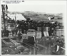
Üçüncü istasyon 1906'da inşa edildiğinde, bir blok kuzeye, şehre yaklaştı. Eddy Bulvarı'nı oluşturmak için yeniden düzenlenmiş olan Garden Road'un önündeydi. Eğer Belmore Parkı dahil, şu anda Central ve Redfern'de demiryolunun işgal ettiği tüm arazi, şirketin Hay ve Cleveland Sokakları arasındaki dört blokluk orijinal seçimiyle çakışıyor.[2] Mevcut istasyon resmi olarak 4 Ağustos 1906'da açılmış ve 5 Ağustos 1906'da yolculara açılmıştır.[9]

Sırasında Vali Macquarie Sidney Terminalinin gelecekteki yeri, sonundaki gişe tarafından işaretlenen yerleşim sınırlarının ötesindeydi. George Caddesi ve girişte Demiryolu Meydanı.[2]
Merkez istasyon hükümet mimarı tarafından tasarlandı, Walter Liberty Vernon. Yeni istasyon, daha önce işgal altındaki bir şantiyeye inşa edildi. Devonshire Street Mezarlığı,[10] South Sydney Morgue, The Convent of the Good Samaritan, Sydney Kadın Sığınağı, polis kışlası ve müfettişin konutu (Pitt Caddesi'nde), Christ Church Parsonage, Yardımsever Asylum (Demiryolu Meydanı önü), buharlı tren deposu (ve Pitt Caddesi Garden Road ile) ve Railway Place'deki bazı konut mülkleri.[2] Manastır, kadın sığınağı ve polis kışlaları, tuğla tarlalarda arabacı olarak çalışan mahkum çeteleri barındırmak için 1819'da inşa edilen "Carters Kışlası" nın orijinal parçalarıydı. Bugünkü bitişik alan Belmore Parkı polis kışlalarından sonra "polis padok" olarak biliniyordu.
Mezarlıktan çıkarılan kalıntılar, Sidney'deki diğer birkaç mezarlığa yeniden gömüldü. Rookwood ve Waverley mezarlıklar. Cesetler taşındı Botanik buharlı tramvay motorları ve düz arabalarla.[5]
1901'de Çalışma Bakanı E. O'Sullivan, "istasyonun tasarımı ve düzenlemeleri sorununu araştırmak" için demiryolu uzmanlarından oluşan [Merkez] İstasyon Danışma Kurulunu kurdu. Üyeler dahil Walter Liberty Vernon hem Yeni Güney Galler demiryolunun baş mühendisleri (sırasıyla demiryolu yapımı ve mevcut hatlar için) hem de Queensland ve Victoria demiryollarının baş mühendisleri.[2] Komite ayrıca yeni için uygun bir tasarım da değerlendirdi. Flinders Street istasyonu içinde Melbourne. Sydney Terminus'un tasarımı, mimar ve demiryolu mühendisleri arasında bir işbirliği olacaktı. Yerleşim düzeni, büyük ölçüde, uygun bir mimari tarzın üzerine yerleştirildiği demiryolu mühendislerinin planlama gereksinimleri tarafından belirlendi. Ancak, ilk proje gerekli konaklamayı içermiyordu ve binanın büyütülmesi bakan tarafından onaylandı. Maliyet tahmini şimdi £ 610,000. Kurul, bakanın "yapının anıtsal bir ihtişam ve güzellik eseri olması gerektiği" dileklerini yerine getirecekti.[kaynak belirtilmeli ]
Yeni terminal için erken bir öneri ve çevredeki alandaki değişiklikler, Sydney Mail 1901'de:[2]
"Tesadüfen gerçekleştirilecek reformlardan biri, Pitt Caddesi'nin demiryolunun yakınında 100 ft'e kadar genişletilmesi olacak. Genişlik, halihazırda devam ettirilmiş olan veya Hükümetin elinde bulunan ve Yardımsever İltica gerekçeleri de dahil olmak üzere, manastır boyunca arazi alarak güvence altına alınacaktır. Pitt Caddesi'nin George Caddesi'ne çarptığı kuzey tarafı. Sonuç, şehrin girişini oluşturmak için sınırlanmış ince, geniş bir cadde olacak ... ... Bay O'Sullivan ayrıca Bay S Horden ile görüşüyor. Gipps Caddesi'ni genişletmek için bir düzenleme yapılıp yapılamayacağına bakın, şu anda herhangi bir yeni bina inşa edilmeden önce dar bir cadde. Bu geniş caddeleri her iki tarafa ağaçlarla dikerek, Bay O'Sullivan şehre muhteşem bir giriş olduğunu iddia ediyor. kurulacak ve ağaçlar yeni istasyonu açacak.Özellikle vergi mükellefine çok ağır bir maliyet getirmeyeceğinden, Sydney'in iyileştirilmesi ve süslenmesi için bu fırsatın kaybedilmemesi gerektiğini düşünüyor. , kullanılan arazinin çoğu zaten tacın mülkü olarak kullanılıyordu. Dört adet çift ve dört adet tek platform veya toplamda neredeyse on iki adet tek platform olacak ... Rıhtımların sonu ile ana binalar arasında 70ft genişliğinde montaj platformu var. Platform düzeyinde rezervasyon ofisleri, bekleme odaları, vestiyer ve bagaj ofisleri, tuvaletler, rahat dinlenme odaları, yemek odaları vb. Yer alacaktır. Bodrum kat mutfaklara, mağazalara, bagaj odalarına, küçük memurlar için ofislere ve bir yemek odasına ayrılacaktır. Büro, meslek, trafik ve denetim şubeleri dahil olmak üzere Demiryolu Komisyon Üyeleri ve personeli için. Demiryolu, yoğun trafik için bir cadde olarak varlığını yitirecek olan Devonshire Caddesi'ni geçecek. Sadece yaya, kabine ve hafif trafiğe 50ft genişliğiyle alçaltılacak ve değiştirilecektir. Şimdiye kadar Devonshire Caddesi üzerinden alınan yoğun trafik, Belmore Yolu boyunca yönlendirilecek ve istasyonun doğu tarafına yapılacak yeni bir cadde. Taksiler istasyona Devonshire Caddesi'nden girecek. Taksiler için çıkış, eğimli bir rampa ve metro ile Pitt Caddesi'ne çıkacak ve böylece yayaların veya tramvayların yolu seviyesinde herhangi bir geçiş yapılmasını önleyecektir. İstasyona ana yaklaşım, George ve Pitt Caddesi'nin kesişme noktasının karşısında olacak ve yaya yolcular, taksiler ve diğer araçlar buraya girecek. Araçların ayrılışı, binanın kuzey batı köşesinden Belmore Yolu'na inen bir rampa vasıtasıyla gerçekleştirilecektir. Yayaların binaya girmesi için bir metro, binanın kuzey batı köşesinin hemen karşısında, Pitt Caddesi'ndeki bir noktadan sağlanacaktır. Tramvay yaklaşmaları, onları diğer tüm trafik ve tıkanıklık sınıflarından tamamen uzak tutacak şekilde tasarlanmıştır ve müdahale ve yaralanma riski tamamen ortadan kaldırılacaktır. Demiryolu trafiğinin şu anda düzenlendiği şekilde Castlereagh ve Pitt Caddesi güzergahı üzerinde ilerlemesi amaçlanıyor, ancak istasyona zemin seviyesinden yaklaşmak yerine, iki hat, Belmore Park'taki bir noktadan 1 inç yükseklikte yükselmeye başlıyor. 20, platform düzeyinde geniş bir sütun dizisi ile sona erecekler. "
Pavyonlar ve bir mansart çatılı bu tasarım, Fransız Rönesans şatosundan güçlü bir şekilde etkilenmiştir. Binanın ölçeği, yaklaşımların ve viyadüklerin düzenlenmesi, zemin seviyesindeki sütunlar ve saat kulesinin konumu, aslında inşa edilmiş olan sonraki şemaya benzer.

Haziran 1901'de, Devonshire Caddesi'ndeki yeni istasyonun sahasının oluşturulması için çalışmalar başlamıştı, 1900/01 PWD Yıllık Raporu, "yeni istasyon için sahanın hazırlanmasında çok sayıda ön çalışma yapılması gerektiğini belirtti. eski mezarlıktan cenazelerin kaldırılması ve kalıntıların alınması için yeni bir mezarlık sağlanması gerekliliği nedeniyle demiryolunun genişletilmesi, binaların yıkılması ve malzemenin bertarafı. şimdi elinizin altında. " "Özel nakil işlemleri 29 Şubat 1901'de başladı ve yılın sonunda 1.145 ceset çıkarıldı." Aileler, kalıntıları kendi seçtikleri bir mezarlığa götürebiliyorlardı, ancak çıkarılan cesetlerin çoğu, devlet masrafları karşılanmak üzere La Perouse'daki yeni mezarlığa taşındı. Belmore Park'tan Fort Macquarie Elektrikli Tramvay'a da 1900-1'de inşa edildi.[2]
Mansart çatılı önceki tuğla ve kumtaşı tasarımı, büyük ölçüde önceki şema ile aynı yolcu, tramvay ve araç ayrımını içeren tamamen kumtaşı terminal binası lehine terk edildi. 1899'da bir Parlamento Daimi Komitesi, büyük kamu binalarının kumtaşı süslemeli tuğladan mı yoksa tamamen kumtaşı ile mi inşa edilmesi gerektiğini tartışmıştı. Bu komite, büyük kamu binaları için kumtaşı kullanılması gerektiğini belirledi.
Hükümet Mimarları Şubesi üyeleri tarafından iki tasarım, Ekim 1901'de cepheler için Bayındırlık Bakanı'na ve Merkez İstasyonun tasarımına ilişkin tavsiyelerde bulunan "Uzmanlar Kurulunun" yorumuyla birlikte Demiryolu Komiserlerine teslim edildi. bu rapora eşlik eden mimari tasarımlardan birinin veya diğerinin güvenle benimsenebileceği görüşündedir. " İki cephe seçeneğinden Gorrie McLeish Blair'inki ünlü bir şekilde seçildi. 1901/02 Yıllık Rapor, bir yıl sonra yaşanan ilerlemeyi anlatıyor, "yıl boyunca çalışmalar hızla ilerledi. Tüm eski binalar ve insan kalıntıları alandan kaldırıldı ve temel taşı Pitt-caddesi ile caddenin köşesine atıldı. 30 Nisan'da yeni Belmore yolu. New-Street'in bilgileri, 2 zincir genişliği, Castlereagh caddesinin uzatılması ve Hay ve Elizabeth Sokaklarının genişletilmesi oldukça ileridir. Tüm sitenin tesviyesi pratik olarak tamamlanmıştır ve harika Belmore ve Prince Alfred Parks için temeller için kazılan kalıntılar doldurularak iyileştirmeler yapılmıştır ".[2]
Kazı hakkında daha ayrıntılı bir açıklama verilmiştir: "Yaklaşık 80.000 metreküplük rıhtım ve ana bina kazıları çıkarılmış ve malzeme, tramvay setlerini oluşturduğu ve genel seviyesini yükselttiği Belmore Park'a kaldırılmıştır. Prens Alfred Park'ın seviyesini yükseltmek için Castlereagh caddesinde kesilen yaklaşık 30.000 metreküp malzeme kullanıldı. "[2]


1902'nin başlarında, "Uzmanlar Kurulu" nun, Merkez'in tasarımına ilişkin tavsiyesinde bulunan "İstasyon binasının yüksekliğinin bir kat ve cephe uzunluğunun önemli ölçüde artırıldığı" tavsiyesinde bulunan "Uzmanlar Kurulu" nun talebi üzerine terminal binasının tasarımı bir kez daha değiştirildi. ve bir doğu kanadı eklendi. Güzel oranlarda bir kule de dahil edildi. Sonuç olarak tamamlanan bina, başlangıçta önerilenden çok daha büyük bir yapı gösteriyor, ancak gelecekte kullanıma gireceği düşünülüyor. Bu arada, bazı bölümler olabilir dışarıda bırakılmalı ve sonradan eklenmelidir, ancak tüm bu azalmaya rağmen, yeni binanın tahmini maliyeti ve ana bina yaklaşık £ İle karşılaştırıldığında 400.000 £ 230,000".[2]

İnşa edilirken, "Yeni istasyonla bağlantılı her şey, büyük yükseltilmiş yaklaşımlardan yeraltında bagaj taşıma sistemine kadar, büyük ölçekte tasarlanmış gibi görünüyor."[11] Listelenmiştir NSW Eyalet Miras Kaydı[3][4] ve şimdi feshedilmiş Milli Emlak Sicili.[12]
Henry Deane, 1902'de Sydney Üniversitesi Mühendislik Topluluğu'na verilen bir konferansta, şu anda yapım aşamasında olan Merkez Tren İstasyonu'nun yerleşimini şöyle anlatıyor:[2] Dersinde, bagaj taşıma, asansörler, su kuleleri, daha sonra maliyet düşürücü bir önlem olarak silinen tren sundurma çatısı, platformlar ve sinyalizasyon gibi tasarımın birçok teknik yönünü tartışıyor. Central için "her zaman gergin insanları korkutan sakıncalı bagaj arabasından kurtulmak" için yeni bir bagaj taşıma yöntemi tasarlandı. İngiltere'de bir baş üstü bagaj taşıma sistemi geliştirilmiştir, ancak Merkez istasyonda "katlar, uygun noktalarda metro ve asansörler vasıtasıyla yeraltında taşınmasına izin vermektedir". Posta da metroyla taşınacaktı.[2]
Tren sundurma çatısı, iki yan açıklığı 78 ft olan 198 ft'lik bir merkezi açıklığa sahip olacak şekilde tasarlanacaktı. Ara destek sağlamak için zemine getirilecek üç pimli kafes kullanılacaktı. Çatı sürekli olacaktı. Bu makas ve çatı konfigürasyonu, Union İstasyonu, St Louis, 1894'te Deane tarafından ziyaret edildi. Böyle bir çatı, Avrupa ve Amerika'daki büyük metropol terminallerine rakip olabilirdi. Platform alanı, önceki istasyonun iki katı olacak ve buna bağlı olarak yolcuların sayısının iki katı olacaktı. Devonshire Street istasyonunun barındırabileceği maksimum yolcu sayısı 20.000 idi; yeni istasyon 40.000 kişi kapasitelidir. Taksi rıhtımının yeri de tartışıldı, yeni istasyonun "atların çatı altında durmasının kesinlikle içermesi gereken kokudan tamamen uzak tutulabilmesi için" binanın içine bir taksi kademesi dahil edilmemesine karar verildi. .[2]
Son tren 4 Ağustos 1906 gece yarısı 1874 istasyonunun 5 numaralı platformundan ayrıldı. O gecenin geri kalanında yolcu konvoyu yıkıldı ve hat eski istasyondan yeni istasyona doğru uzatıldı. Western Mail 5 Ağustos 1906'da saat 05: 50'de yeni istasyona vardı.[13] İki istasyonu ayıran Devonshire Caddesi, insanların demiryolu hattını geçmesine izin vermek için bir yaya alt geçidi haline geldi ve şimdi birçok kişi tarafından Devonshire Caddesi Tüneli olarak biliniyor.[5]
85.6 metre boyunda (281 ft)[5] Saat kulesi içinde Ücretsiz Klasik stil istasyonun kuzeybatı köşesine eklendi ve 3 Mart 1921'de açıldı. Saat, Fairfax & Roberts'ın kurucu ortakları Richard Lamb ve Alfred Fairfax tarafından tasarlandı.
Tramvay yaklaşıyor ve Belmore Parkı


İlk istasyon binası ile kesintisiz bir eksende, Belmore Park başlangıçta Hay Caddesi'ndeki ilk Saman ve Mısır Pazarlarının önünü açtı. Üçüncü istasyon bir blok daha kuzeyde konumlandırıldığında, Belmore Park'ın güney tarafına bağlandı. Park daha sonra, istasyonun komuta eden şehir cephesine tesadüfen yeşil bir folyo sağladı.[2]
1902'de Henry Deane başkanlığındaki Demiryolu ve Tramvay İnşaat Şubesi, "Yeni yolun hem kuzey hem de güneyindeki Pitt-Caddesi'ndeki istinat duvarı ve dükkanların tamamı için ofiste plan ve detay çizimlerinin hazırlandığını bildirdi. İstasyonun önü, ayrıca Devonshire-Street metrosu ve drenaj, telefon tünelleri ve c dahil tüm bodrum katları için. " Bu aşamada eserlerin tahmini maliyeti 561.600 pound idi, ancak "tahmininin aşılması muhtemeldi".[2]
Gerekli tramvay sapmaları, 2 mil ve 60 zincir yolu, 1901-02'de günlük işçilik kullanılarak döşendi. Ray, traverslere yerleştirilmiş raylardan oluşuyordu. Eğri ve direkler yerel mühendislik firmaları tarafından üretildi. Clyde Mühendisliği Co. Kalıcı Yol (yani parkur) İngiltere veya Amerika'dan ithal edildi. İstasyonun ilk etabının inşaatına Haziran 1902'de başlandı ve Ağustos 1906'da tamamlandı. 30 Haziran 1903'e kadar aşağıdaki işler tamamlandı:[14][2]
"... kaldırılan toplam toprak miktarı yaklaşık 250.500 metreküp. Bu, istasyon alanını gerektiği gibi yükseltmek için kullanıldı. Belmore Park, tramvayları istasyona taşımak için yükseltildi ... The Sports Grounds Moore Parkı (bisiklet zemini) oluşturuldu ve kilin en iyileri Beyler'e atıldı Goodlet & Smith, tuğla işlerinde ... Ana binaların temellerinin tamamı sökülerek betonla kaplandı. 21 Temmuz 1902'de, ilk taş inşa emri Bay Saunders'a verildi. Pyrmont Taş ocağı. 6 Ağustos'ta Müfettiş Murray, taş yontma işine başlamak için Pyrmont Ocağı'na gitti. 7 Ağustos'ta 11 duvar ustası çalışmaya başladı ve 18'inde ilk yontulmuş taş Pyrmont Ocağı'ndaki işlere indirildi ve 19 Ağustos'ta varış köprüsü olan 3 Nolu İskeleye yerleştirildi; ve o tarihten bu yana 127.000 fit küp yerine inşa edildi. Bu taş, Devonshire caddesi yakınında Hay-caddesi ve Ambulans Deposu arasındaki Pitt-caddesi istinat duvarı yapımında kullanıldı; iskeleleri impost ve kiriş yatağı seviyesine kadar taşınan tramvay geliş ve gidiş köprüleri. Pitt-caddesindeki mağaza cepheleri ve pasajlar ... Pitt-caddesinden ana binaya ana binaya kadar dükkan cepheli ve ön duvarlı pasajın tamamı, doğu kanadı da dahil olmak üzere binanın en doğu ucuna kadar taşınmıştır. birinci kat seviyesi.
1908 Sidney Şehri İyileştirme Kraliyet Komisyonu ve Banliyöleri, araç erişimi sağlarken Belmore Park ile istasyon binası arasındaki ölçek farklılığını çözmeye çalışan iki şema sundu. Şema tarafından sunulan John Sulman Belmore Parkı çevresinde, üst üste iki dairesel yoldan oluşuyordu. Ancak Komiser, Norman Selfe tarafından hazırlanan daha az ihtişamlı bir Planı tercih ettiler.[2]
"Başlıca özelliği, Belmore Park'ın bir yandan genişletilmiş Pitt caddesinin doğu yarısındaki yükseltilmiş yollar ile diğer yandan genişletilmiş Elizabeth caddesinin batı yarısı arasındaki istasyon platformu seviyesine yükseltilmesidir. Eddy-caddesi boyunca viyadük ve yükseltilmiş parkı Hay-caddesi hizalaması boyunca desteklemek için bir istinat duvarı birleştiriyor. "
Her iki plan da denenmemiş olmasına rağmen, Selfe'nin önerisi, şehre elektrik bağlantısının uzatılmasına izin vermek için 1925'te inşa edilen Elizabeth Caddesi rampasında hatırlatılır. Söylemeye gerek yok, park asla montaj platformunun yüksekliğine yükseltilmedi.
Doğu cephesi


Sydney Terminus'un Elizabeth Caddesi cephesi daha az ilgi gördü. İşçi sınıfı teraslarına bakan Surry Tepeleri Doğu kanadı, kaynak sıkıntısı nedeniyle istasyonun ilk etabının 1906'da tamamlanmasını hızlandırdığında taştan ziyade tuğladan yapılmıştı. Elektrik şehri ve banliyöleri sağlamak için orijinal komplekse yeni platformlar eklendiğinde, genişleme için açık bir yerdi. Büyük istasyon binası, Elizabeth Caddesi rampası ile sokak düzeyinde görünümden gölgelenmiştir ve daha sonra şehir bağlantısına giden yarı dairesel klasik giriş portikosu, rustik bloklar ve ana binanın ağır işleyişiyle rafine bir tezat oluşturmuştur.[2]
Merkez İstasyon Savaşı (1916)
Bir isyan Merkez İstasyon Savaşı, 1916'da yaşandı. Kamp koşullarına isyan eden askerler otellere baskın düzenledi. Liverpool ve komuta edilmiş trenlerle şehre gitti. Merkez istasyona vardıklarında isyancılar istasyon tesislerini yok etmeye başladılar ve öfkeli isyancılar ve Askeri inzibat. Bir isyancı vurularak öldürüldü ve birkaç kişi yaralandı. Silahlı çatışmanın geriye kalan tek kanıtı, platform 1'in girişindeki mermerde küçük bir kurşun deliği.[15] Bu olay, Saat 6 kapanış Yeni Güney Galler'de 1955'e kadar süren 1916'daki otellerin oranı.[5]
Elektrifikasyon
Elektrifikasyon için orijinal teklif, North Shore hattı, şuradan Hornsby -e Milsons Noktası, raylı sistemin geri kalanına etki etmeden elektrikli hale getirilebilecek ayrı bir hat. Ancak, Şehir Yeraltı Demiryolunun yapımının gerekliliği ve bir Sidney Limanı Köprüsü, Illawarra ve Bankstown program, elektrifikasyonun önerilen bu genişletmelerle ilişkilendirilebilmesi için değiştirildi. Well Street'ten Redfern sekiz yolu Şehir Demiryolu olarak devam ederken, dördü ülke trenlerini Sidney Terminaline taşıyacaktı. Bir yer üstü istasyonu, yolcuların ve bagajların Sidney Terminaline transferine izin veren bir bağlantı içerecektir. Bu yeni istasyon doğu tarafında inşa edildi.[2]
İstasyon binalarının güneyinde, şehir ve banliyö hatlarının elektrifikasyonu ve genişlemesini sağlamak için inşa edilen ek işler, Cleveland Caddesi Köprü ve üst geçitler. Devonshire Street metrosu ve Devonshire Street duvarı, yeni banliyö bölümü boyunca genişletildi. Elizabeth Caddesi'ndeki yeni viyadük, Eddy Caddesi, Campbell Caddesi ve Hay Caddesi üzerinde yeni köprüler ve Elizabeth Caddesi boyunca yeni bir istinat duvarı içeriyordu.[2]
Modernizasyon

Modernizasyon programları 1955'te ve yine 1964'te gerçekleştirildi. 1955 çalışmasında, bir rezervasyon salonu oluşturuldu (eski dinlenme odasında, şimdi demiryolu barı). Duvarları demiryolu sahnelerini tasvir eden duvar resimleri sıraladı ve yere Avustralya'nın terrazzo haritası yerleştirildi. In October 1980 a modernisation program at the Sydney Terminal commenced. The objective of the work was to improve the facilities for both passenger convenience and comfort. The start of this modernisation program coincided with the 125th Anniversary of the NSW Railways and it was at a time when many major service advances were being made to the State Rail System.[2]
Darling Harbour line
In addition to the construction of the main trunk line between Sydney and Parramatta in 1855, a branch line between Darling Harbour and the Sydney Yard, with a cutting and underpass to carry the line under George Street, was also constructed. This line was to allow for the transfer of goods to be exported by ship, primarily wool bales. In the first decades of settlement goods were loaded and unloaded in Sidney Koyu, however, as the city expanded the wharves extended round into Cockle Bay (Darling Harbour). The presence of the rail link would have influenced the development of this harbour. The Darling Harbour Line was one of the first cuttings and overbridges to be constructed as part of the NSW Rail network. In contrast to later structures sandstone was used to line the walls of the underpass and to form the overbridge. The Darling Harbour Line partially followed the line of an existing water course, the Blackwattle Creek. Subsequent alterations to the layout of Railway Square have resulted in extensions to the overbridge.[2]
The line fell into disuse with the demise of Darling Harbour as a working harbour in the second half of the 20th century. Part of the railway, from Haymarket at Hay Street, near the Powerhouse Müzesi bağlanmak Metropolitan Goods railway line to Lilyfield and Dulwich Hill, became part of the new light rail Dulwich Hill Hattı. Trams entering the city via the Dulwich Hill Line deviated from the Darling Harbour Line at Hay Street to run via surface streets to the Central station colonnade.
For a time, the remainder of the former Darling Harbour Line, from Sydney Yard to Hay Street, remained disused and functional, and was used to transfer trains to the Powerhouse Museum. Most of this section, from the Devonshire Street Tunnel to Hay Street, were converted to a pedestrianised linear park called "Mal Hattı " in stages in 2012 and 2015.
The final part of the Darling Harbour Line, a tunnel under Railway Square, is intact but disused. There are proposals to also pedestrianise it.[16]
Sydney Yard
The first Sydney railway workshop, constructed c. 1855, was a substantial two storey sandstone building with arched openings to both floors and a slate roof. A boiler, for the production of steam, was located at the southern end of the building. By 1865, a timber extension had been constructed over a section of track to allow the locomotives to be worked on under cover. A blacksmiths forge was located in an adjacent single storey building. In contrast with the first Redfern Station building (Sydney Terminal) the main workshop building was an elaborately detailed sandstone building, with a rock-faced ashlar base, quoins and sills. The use of substantial and well-detailed sandstone buildings on the site was to continue with the construction of the twin-gabled goods shed, the Mortuary Station and finally the present station building and its approaches.[2]
Originally the Sydney Yard occupied the area between the passenger station and the two storey workshop building. Initially, timber and corrugated iron sheds were built, however, these were soon replaced with more substantial masonry building. Gable-ended locomotive and carriage workshops were built here. Although no architectural drawings of these buildings have been located it is assumed that metal roof trusses and cast iron internal columns were used, similar to the structural system favoured in England, and later employed at Eveleigh. Of these sheds, the most elaborate was the Second Goods Shed, built in the late 1860s. The building was as, if not more, elaborate than many English examples. It was unusual, even in the 19th century, for this level of decorative detail to be employed on such a utilitarian structure as a goods shed, the standard of building obviously representing the level of importance of the yard.[2]
Extensive facilities were required to keep the locomotives in good working order. The Sydney/Redfern yards were extended towards Elizabeth Street and the Exhibition Ground (Prince Alfred Park). Until the construction of the railway workshops at Eveleigh in the mid-1880s the majority of the maintenance work was undertaken at the Sydney/Redfern Yard. In 1884 the yards included a gasworks (c. 1882), gas holder, a carriage works and the locomotive shop (by 1865). A turntable connected the now considerably extended main workshop building, one of the two blacksmiths shops and the repairing shed. All of these structures have been demolished. Further towards the park, in the area now known as the Prince Alfred Sidings were located the carpenters shop, the second blacksmiths shop and an office. These buildings are the only remnants of the Sydney Yard. Little physical evidence remains of the layout or the functioning of this once extensive railway yard as many of the structures were removed to allow for the construction of platforms 16-23 and subsequently the city electric station.[2]
Mortuary Station

The Mortuary Station, or the Receiving House as it was known, was originally constructed for funeral parties, the mourners accompanying the coffin on the journey to the necropolis -de Rookwood Mezarlığı. Most documentary sources date the building as being constructed in 1869, however, the outline of the station first appears on the 1865 MWS&DB (Metropolitan Water Sewerage & Drainage Board) plan. The rail lines had not yet been constructed. The inner Sydney cemetery or New Burial Ground, also known as the Sandhills or Devonshire Street station, was located in the Brickfields, a site now occupied by the main terminal building. By the 1840s this cemetery was overcrowded and a new location, in close proximity to a railway line, was required. In the early 1860s a site at Haslem's Creek was selected for the new cemetery. To distinguish the cemetery from the surrounding residential area of Haslem's Creek the cemetery became known as the Rookwood Necropolis. A station was constructed within the Rookwood Necropolis.[2]
Kolonyal Mimar, James Barnet, designed both receiving houses (mortuary stations) in the mid 1860s. The station within the Necropolis has subsequently been relocated and modified to form the nave of All Saints Church of England, Ainslie, DAVRANMAK. Although both stations are Gothic Revival in style, the plan and detailing of each varies considerably. Barnet's two station buildings were designed to celebrate the passage of the coffin to and from the train. In the Victorian Era, mourning the dead was a prolonged ritual with elaborate rules concerning behaviour and dress. The train trip to Rookwood became part of this ritual.[2]
The regular funerary train service to the Rookwood Necropolis commenced in 1867, two years before Mortuary Central and the Rookwood Station had been completed. By 1908 there were four stations within the necropolis, named Mortuary Stations 1-4, with the Sydney receiving house being known as Mortuary Central. Mortuary Central was built by Stoddart & Medway from Pyrmont sandstone and completed in March 1869. The carvings were executed by Thomas Duckett and Henry Apperly. From the variation claim submitted by the builders it would appear that a slightly larger building, with more decoration was built than originally intended. The form of the Mortuary Station, with the large porte-cochère, clearly indicates that it is not a church. A colonnade of trefoil arches and foliated capitals forms a screen to the platform. The same arch form being employed for both ends of the platform and for the octagonal porte-cochère to the west. The station building is above street level, with a flight of stairs leading to the platform level. Ramps to the north and south were used for carriages. Internally were the ticket office, two vestibules and retiring rooms.[2]
Photographs taken in the early 1870s clearly show the decorative detail of the building. Two colours of stone were employed, a darker shade of the arches and the surrounds to the medallions, the lighter shade being reserved for the ashlar work. The two shades of stone were employed internally in the same manner. The arcade covering the platform is very elaborate, with its curved queen post truss roof, with ripple iron above following the curve, blind arcading to the west that mirrors the eastern arcade, and geometric tiled floor. Even the platform benches follow the Gothic Revival theme of the design, resembling pews. This platform would have contrasted with the more utilitarian Redfern station building, designed by John Whitton and constructed in the early 1870s.[2]
The stonework of the Mortuary Station was very delicately worked, with a number of different foliage motifs forming the capitals, the trefoil spandrel panel within the main arches and the medallions. A star and zig-zag motif was used on the soffit of the arch, ball flowers on the cornice brackets and a zig-zag on the cornice. The original roof covering was slate, with a pattern of half round and diamond slates being employed at the ridge and above the eaves. The octagonal porte-cochère terminates in a bell-cote, whose detail is a miniature of the main trefoil arch and medallion motif. The bellcote was roofed with lead. Decorative metalwork is also employed, as finals, as a cresting and as balustrades. A leaf motif was used for the balustrade to the porte-cochère and repeated in the panels of the elaborate timber gates that lead to the platform. A palisade fence that stepped down to follow the slope and matching gates separated the station from the street and a picket fence lined the ramps. sivri uç of Mortuary Station (the Bellcote) was a distinctive townscape element that could be seen from the Exhibition Grounds (Prince Alfred Park) and from Sydney University.[2]
The arcade detail of Mortuary Central, with its pointed trefoil arches, medallions and foliated capitals, is reminiscent of the hotel at St Pancras İstasyonu Efendim tarafından George Gilbert Scott, designed in 1865 and constructed in 1868–73. There are few other station buildings, either in Australia or the United Kingdom, with this level of decorative detail. The construction of special mortuary stations is rare, with no other examples having been located. The Mortuary station became part of the rail complex at Central after the new station was constructed in 1906, although it remained physically separate from the new station buildings.[4]
By the late 1970s the station had deteriorated, slates were missing from the roof and the stonework was covered in graffiti. A restoration program was undertaken in 1983.[2]
Railway Institute
The Railway Institute on Chalmers Street was constructed as a venue for the railway employees, providing a setting for both educational activities and social functions. It is reputed to be the first railway institute in Australia and provided a range of services for railway employees such as evening classes and a library. A competition was held for the design, which was won by the architect Henry Robinson. It is a Queen Anne Revival style building, based on English prototypes such as the London Board Schools. The design was the first use of Marseille roof tiles for public buildings in Australia. Many public buildings were designed by competition c. 1890, during the period of transition between the Colonial and Government Architects Offices. The practice was abandoned in the mid-1890s due to the partiality of the judges.[2]
When the Railway Institute was constructed in 1891, the building was located on the corner of Devonshire Street and Elizabeth Street, at the northeastern corner of the Sydney rail yard. The surrounding streets and the carriage way have subsequently been modified. A carriage-way lead to the porte-cochère, enabling people attending social functions to enter the building without getting wet. In addition to the library there were two halls, a large hall, with a stage, and a smaller hall on the ground floor. The detail of this space is largely intact and there are few examples of small scale halls of this period remaining in Sydney. A single storey addition to the building, designed by the Government Architect, Walter Liberty Vernon, was added in 1898 to the southeast of the main building.[2]
Classes, such as engineering drafting, and examinations for railway employees, were held in the Institute. The building was also utilised during emergencies such as the 1919 influenza epidemic when women volunteers manufactured face masks (for railway employees). There are few examples of Institutes of this period that provided such a high level of facilities for the benefit of the employees. The names on the honour board reads as a "who's who" of railway personalities.[2]
İstasyon düzeni
Central Railway Station has buildings concentrated on its northern boundaries that are fed by large rail yards behind. Together they form part of the fabric of the city of Sydney and form boundaries to its inner suburbs. The location of this station is on land that has been in continuous government use since the commencement of European settlement. Various forms of public transport have radiated from this site since 1855.[2]
Sydney Terminal building


The most prominent part of Sydney Central Station, visible from many parts of the City and surrounding area, is the 1906 sandstone main terminal building, referred to as the "Sydney Terminal Building" by railway staff. It is sited to dominate its surroundings and to mark the importance of the railways and its service to the state and the city.
The main concourse and platforms are elevated above the surrounding roads. This elevated siting also permits the use of the topography to gain road access to more than one level enabling the development of an extensive subterranean luggage network and separation of differing modes of transport. The commanding position of the Terminus with large areas of open space sloping away from the building continues the public domain of Railway Square whilst maintaining a clear vista of the Terminus from the surrounding area. The Terminus, and in part the Parcels Post Office, create a formal edge to Railway Square.
On the main Eddy Avenue façade, the Terminus comprises a sütun sırası and porte-cochère, which originally provided an undercover area for passengers transferring to and from trams. After the removal of the original Sydney tram network, the upper level colonnade was used by motor vehicles, but it is now again used by trams on the Dulwich Hill Hattı.
The main concourse, called the "Main Assembly platform", is located on the upper level and is the centre of the Terminus, around which all of the ancillary functions, such as refreshment rooms, waiting rooms and the booking hall, were arranged. As originally built, the main terminal building also had terraces or "decks" on the east and west sides, which were accessible by vehicles. The main concourse "platform" was accessed from both the East and West deck. The main concourse is dominated by a large vaulted roof over the concourse and elaborate duvarcılık, öncelikle Sidney kumtaşı.
The station opened on 5 August 1906 with 11 platforms, but was soon expanded to 15, and by 1913 had 19.[17] As part of the construction of the electrified city railway in the 1920s, the existing station was cut back to 15 platforms with new platforms built to the east of the existing station. As part of the project, platforms 10 to 15 were electrified, with platforms 1 to 9 following in 1956.[17][18]
The current 15 Sydney Terminal platforms run perpendicular to the main station concourse and all are dead ended with the buffer stop. They are arranged as seven double platforms and one single platform, each with an awning, servicing a total of 15 tracks. Platforms 1–3 are for country and interstate services, while the remainder are for interurban services.[2]
Platforms 1–10 have a centre run-round track, which was for locomotive-hauled trains. It enabled the locomotive to uncouple from its train and either depart or re-couple on the other end to pull the train to the next destination. There was extreme pressure on the speed to ready a train for the next destination due to the lack of platform space and a steady growth of rail patronage. These centre lines are now used for storage of electric rail car sets in off peak times. The platforms feature long timber-framed canopies over some of the platforms (incorporating Howe kafesler ). Timber was used in lieu of steel because of the high cost at the time of importing steel.[2]
The only locomotive hauled trains now using Sydney Terminal are the Indian Pacific and special trains which usually use Platform 1. Platform 1 has always been the main out of Sydney Station with the longest platform. Platforms 1 and 2–3 were lengthened to their present length in 1962 covering the skylights to the Devonshire Street Subway for diesel hauled trains like the Southern Aurora. All long-distance NSW TrainLink XPT ve Xplorer services and the Great Southern Rail Hint Pasifik terminate at Central. These generally use Platforms 1 to 3, although when the Hint Pasifik is in the station occupying both Platforms 2 and 3, some NSW TrainLink regional services use Platforms 4 to 12.
Central Electric Station

To the east of the Sydney Terminal building are ten further platforms, used by suburban Sidney Trenleri services and by a limited number of NSW TrainLink intercity services during peak hours.
As part of the construction of the electrified city railway in the 1920s and the electrification and expansions of the Sydney suburban lines, the existing station was cut back to 15 platforms with new Platforms 16 to 23 built on the station's eastern side in 1926. The Electric Station was part of the construction works overseen by Bradfield that included the excavation of the tunnels, the building of the Harbour Bridge, and electrification of the suburban rail network.
The platforms continue north via a six-track viaduct paralleling Elizabeth Caddesi built to the north, passing over Campbell Street and Hay Street, and ending at Goulburn Caddesi where it enters tunnels to connect with the City Circle underground rail system and the North Shore over the Sydney Harbour Bridge.
Platforms 16 to 23 are also elevated, but are served by a lower level concourse at street level. Railway staff refer to this part of the station as the "Central Electric Station", or "Central Electric System". The two stations were managed and staffed as separate entities.[2] This section of the station is also referred to as the "suburban" platforms. There are two major pedestrian entrances to Central Electric: one at Elizabeth Street and one at the top of Eddy Avenue ramp. Both are constructed of Maroubra kumtaşı klasik detaylarla.[2][19](p92–97)
The four island platforms allow four eight trains to use the station, four trains in each direction. South of these new platforms, a series of flying junctions were built. This involved the four southbound tracks passing beneath the northbound tracks with a series of elmas geçişleri allowing trains to cross lines without impeding trains traveling in the opposite direction.[17]
In February 1926, Platforms 18 and 19 of the steam station were wired for electric trains with a demonstration run from Sydney to Hurstville. This wiring was transferred to Platforms 21 and 23 and Platforms 14 and 15 were wired for Bankstown electric train services commencing October 1926 and later worked into St James. Olarak Homebush electrification was completed, Platforms 17 and 18 were wired. Electric trains to Hornsby via the main line commenced on 21 January 1929. Trains to Hornsby used Platforms 16 and 18. Steam services to Parramatta ve Liverpool were converted to electric in November 1929. Western electric trains began operating through to Wynyard from 28 February 1932.[20]
Two further underground platforms were built as part of the Doğu Banliyöler Demiryolu, bringing the total number of platforms in the suburban section to ten. Construction commenced in 1948 but the line was not finished until 1979. While the plans called for four platforms, two (for the Southern Suburbs line) were intended to be used in the future and have never been brought into service. They were for a time used for archival storage by the railways.
metro istasyonu
A construction project began in 2018 to construct two new underground platforms to serve the Sydney Metro City ve Güneybatı, and a new underground concourse called Central Walk. The new platforms are being built beneath Platforms 13-14.[21] In November and December 2018, Platforms 12/13 and 14/15 were demolished. A temporary Platform 12 was erected in January 2019.[22]
Indicator board

When opened, Central station had an indicator board with 22 vertical panels. It was replaced in June 1982 by computer screens with the original indicator board conserved by the Powerhouse Müzesi.[23] In June 2015, a new elevated 11-metre-long (36 ft) indicator board was installed on the main concourse on the same standstone base as the original board.[24]
Devonshire Caddesi Tüneli
After Central was built in 1906, Devonshire Street, to the north of the old station, became an underpass, now called the Devonshire Caddesi Tüneli or Devonshire Street Subway. The underpass allows pedestrians to access the eastern "suburban" section from Railway Square and Chalmers Street.[25] To the west, the tunnel continues under Railway Square and connects to Mal Hattı – the former Darling Harbour Line railway line which has been converted to a park and pedestrian pathway to Ultimo ve Darling Limanı.
Demiryolu Meydanı
The western side of the Sydney Terminal building leads down to Railway Square, originally Central Square, at the junction of George and Pitt Sokaklar. Although Railway Square no longer signifies the entrance to the interior of the colony, it has always channelled traffic from the southern parts of the city and out west to Parramatta. From the building of the first railway terminus at Devonshire Street in 1855, it was an important focus for the arrival of country persons to the city and later commuters into the city.[2]
The importance of the relationship between the Sydney Terminus and Railway Square is reflected in the elevations of the main building. Here the dominating presence of the clock tower, completed in 1921, marked the arrival and departure times, the beginning and end of a workman's day. Before the spread of the suburbs, a workman could make a return trip home to eat dinner in his lunch hour.
Parcel Office building

To the west of the southern end of Platform 1 is the Inwards Parcel Office. Bu yükleme alanı for parcels and mail from the post office. The mail was loaded via a tunnel from the post office. The Parcels Post Office is an unusual urban building, being designed to be viewed from three sides. Its symmetrical, boldly modelled elevations and its siting in the middle of an open space give it the presence of a public monument or sculpture. Due to the oblique road approaches to the Railway Square this building forms a strong element within the Sydney Terminal Precinct.[2]
The Parcel Office building is now an apartment-hotel, managed by Adina.
Sydney Yards
South of the Devonshire Street Tunnel, a large rail yard extends to the Cleveland Street Bridge, linking the Sydney Terminal platforms (1-15) with the railway lines extending west. The track layout to Platforms 1–15 have remained virtually unchanged since they were originally laid out in 1906. Major items from its period as a steam locomotive hauled train yard have been removed. These include the Eastern Carriage shed demolished in 1986, Coal Stages, and Engine Docks at the head of each platform. Ash pits and water sütunlar that were part of the yard have also been removed. There is only one "yard controller" remaining within the Yard. Previously, at least two Signal Boxes would have been located in the Yard at any one time, but these have been removed due to the mechanical interlocking system being computerised and pneumatically operated.[2]
The Yard buildings have been altered significantly since the Eastern Carriage Shed was demolished. This large shed divided the central yard from the central electric lines. The land where the shed once stood lay vacant until the construction projects begun in 2018. Remaining structures signifying the division of the yard are the Cleaners Amenities and the former Timetable Office with the garden. The Rail Yard connects to the passenger platforms of Sydney Terminal which are as originally designed and built, with the infrastructure for steam locomotives having been removed - these being water columns between each track near the buffers. However, the concrete süpürgelikler kalmak.[2]
The open space of the rail yards adds to the experience of arrival to the city from the north and south by opening up vistas to the imposing Sydney Terminal with its landmark tower. This open space permits the imposing Terminus and its Tower to be visible when viewed from a distance much as it was intended when originally built. The Terminus and its approaches define formal urban spaces in the city fabric.[2]
Western Yard
The Western Rail Yard lies west of the westernmost main line track leading to Platform 1 (No. 1 Main Line), and extends to the Regent Street boundary to the west, Devonshire Street Subway to the north and Cleveland Street Bridge to the south. Until the construction project begun in 2018, the track layout of this yard had remained virtually unchanged since 1906. The rail sidings that take up the bulk of the land area were known as the "Botany Road Yards". These siding lines are still in service but are seldom used. The lines were used as storage yards for making up passenger trains and for goods being loaded and unloaded at the Parcel and Goods Sidings. This was a major activity at the Sydney Terminal that has become obsolete due to the introduction of technological changes such as fixed sets of rail cars, and the phasing out of locomotive-pulled trains. Darling Harbour Line branch line formerly cut through the precinct providing access to Darling Harbour Goods Yard. This is no longer in use, and part of the former line is now the Goods Line, a lineal park connected to Devonshire Street Tunnel.
The underpass and overbridge date from 1855. The Mortuary Station with its siding and platform is on the boundary of this rail yard, facing Regent Street, and is visible from Railway Square because of the low scale of buildings in the Western Yard. Rail access to the Mortuary Station was from the main lines near the Cleveland Street Bridge, and has remained in service since the mid-1860s.[2]
Nearer to the present main station building were the West Carriage Shed, demolished in 1999.[26][27] This was the last remaining carriage kulübe at Central Station. The six rail lines that enter the shed were connected to the yard through tunnels at the end of Platform 1.
The Yard was designed for locomotive-hauled trains. As this technology has gone out of use except for the Hint Pasifik and Special Trains the yard has little present functional use. With locomotive hauled trains the trains were marshalled for running in one direction. It has the locomotive at the head of the train and a brake van near the rear. This meant that trains when ending their journey had to be remarshalled before commencing their journey out of Sydney Station. The introduction of trains with driving positions at both ends of the train no longer require this process. As the station originally handled locomotive hauled passenger trains for suburban, country and interstate service this activity was considerable. Most of the steam loco facilities and trackwork has been removed. The decline in shunting and the removal of coal and water storage has seen a reduction in the level of activity in the yard. Although it has progressed through various configurations, the landscape has maintained the same ground level since 1856 with its final layout being enlarged in 1906 by the removal of some houses and the realignment of Regent Street to its present format.[2]
Parcel Dock
The Parcel Dock was physically connected with the main station complex and had four platforms (two dock platforms) for the use of mail trains. Due to the decline of parcel delivery by rail, this was cut back to serve a motorail loading ramp (for the loading of automobiles) for the Hint Pasifik. The space where the mail sidings were is now a Gençlik Yurtları Derneği hostel named the Sydney Railway Square YHA. The hostel rooms are modelled on old train carriages.[28]
Former Prince Alfred Sidings
The Prince Alfred Sidings were formerly to the south of Platform 23 and on the eastern perimeter of the site, making up the boundary with Prince Alfred Park to the southeast. The Prince Alfred or "PA" electric car sidings were built only after the flyovers. Prior to the construction of the electric lines, the yard was a goods yard containing Produce and Goods Sheds as well as the first carriage shed. All have been removed from this precinct. The Yard is a small part of the original Sydney yard, of which a number of buildings remain which date from 1870. Later additional buildings are associated with the 1926 Electric Suburban System. The construction of the electric system reduced the width of the Prince Alfred Sidings, and trains within this yard needed to be protected because of vandalism. The Electric Sub Station is part of the 1926 electrification works and is linked with the sub station at the Sydney Harbour Bridge. It also contains air compressors for the operation of pneumatic points within the Yard and the City Circle Lines. Bir istinat duvarı forms the boundary with Prince Alfred Park; it has been incorporated into the rear wall of the blacksmiths workshops. A number of mature trees are growing on the boundary, the largest being a Moreton Bay Fig at least 80 years old.[2]
The Prince Alfred sidings were closed in August 1995 and then demolished to make way for the Havaalanı hattı, which enters a tunnel built into the retaining wall of Prince Alfred Park.[29]
Platformlar

Central serves all Sydney suburban lines except for the Cumberland Hattı. The platforms are numbered from 1 to 25, with 1 being the westernmost platform and 25 being one of the easternmost. Platforms 1 to 15 are above ground terminating at the Sydney Terminal Building. Platforms 16 to 23 are above ground and part of the suburban station to the east of the main building. Platforms 24 to 25 are underground. New platforms are being constructed under Platforms 13 and 14 to serve the future metro line.
| Platform | Hat | Durdurma deseni | Notlar |
| 1 ila 3 | hizmetler Grafton, Kumarhane & Brisbane | Platforms 1 to 15 are terminal platforms[30] | |
|---|---|---|---|
| hizmetler Armidale & Moree | [31] | ||
| hizmetler Canberra, Griffith & Melbourne | [32] | ||
| hizmetler Dubbo & Kırık Tepe | [33] | ||
| Hint Pasifik | hizmetler Perth | [34] | |
| 4 - 12 | hizmetler Newcastle üzerinden Strathfield | [35] | |
| hizmetler Lithgow & Bathurst | [36] | ||
| hizmetler Kiama | [37] | ||
| evening peak services to Moss Vale & Goulburn | [38] | ||
| special event services to Olimpiyat Parkı | [39] | ||
| morning & evening peak hour services to Hornsby üzerinden Strathfield | |||
| 13 to 15 | kapalı | closed for construction of Sydney Metro underground platforms | |
| 16 | hizmetler Berowra üzerinden Gordon | [40] | |
| hizmetler Gordon | [41] | ||
| evening peak services to Newcastle üzerinden Gordon | [35] | ||
| 17 | hizmetler Şehir Çemberi üzerinden Belediye binası | [42] | |
| hizmetler Şehir Çemberi üzerinden Belediye binası | [43] | ||
| 18 | hizmetler Richmond & Emu Ovaları | [44] | |
| hizmetler Hornsby üzerinden Strathfield | [41] | ||
| 19 | hizmetler Parramatta & Leppington | [45] | |
| 20 | hizmetler Şehir Çemberi üzerinden Müze | [43] | |
| 21 | hizmetler Şehir Çemberi üzerinden Müze | [45] | |
| 22 | evening peak services to Macarthur üzerinden Sydenham | [42] | |
| hizmetler Lidcombe & Liverpool üzerinden Bankstown | [43] | ||
| 23 | hizmetler Revesby, & Macarthur aracılığıyla Havalimanı | [42] | |
| 24 | hizmetler Bondi Kavşağı | [46] | |
| hizmetler Bondi Kavşağı | [37] | ||
| 25 | hizmetler Cronulla & Şelale | [46] | |
| hizmetler Port Kembla & Kiama | [37] | ||
| 26 & 27 | Asla tamamlanmadı[47] | used only for archival document storage[48] | |
| Asla tamamlanmadı[47] | used only for archival document storage[48] |
Hizmetleri bağlama
Hafif raylı


Central Grand Concourse is the eastern terminus of the Dulwich Hill Hattı that operates to Çin mahallesi, Darling Limanı, Pyrmont and the inner western suburbs. The light rail stop is in an outside concourse area, near the main waiting area and departure hall. This area was originally designed for trams, and as such was used by tramvaylar until 1958, when the service was withdrawn. It was known as Railway Colonnade and then Central. Light rail services operate in a clockwise direction, whereas the trams operated in an anti-clockwise direction.
MİA ve Güney Doğu Hafif Raylı Sistemi itibaren Circular Quay -e Kingsford ve Randwick also run via Central:[49] its nearest stops are Haymarket Stop, at Rawson Place to the northwest, and Central Chalmers Street, on Chalmers Street to the east.
Otobüs hizmetleri
Many bus services depart from the adjacent Eddy Avenue or from the nearby Elizabeth Caddesi veya Demiryolu Meydanı.
Koç hizmetleri
Long distance coaches depart from the western forecourt and Pitt Street:
- Avustralya Geniş Koçları operates services to turuncu
- Ateşböceği Ekspresi operates services to Melbourne ve Adelaide Melbourne üzerinden[50]
- Greyhound Avustralya operates services to Brisbane, Byron Körfezi, Canberra and Melbourne
- Murrays operates services to Canberra
- Port Stephens Koçları operates services to Fingal Körfezi
- Premier Motor Servisi operates services to Brisbane and cennet[51]
Miras listesi
Sydney Central station was listed on the Yeni Güney Galler Eyalet Miras Kaydı on 2 April 1999, as a place which is important in demonstrating the course, or pattern, of cultural or natural history in New South Wales, and in demonstrating aesthetic characteristics and/or a high degree of creative or technical achievement in New South Wales, as well as having a strong or special association with a particular community or cultural group in New South Wales for social, cultural or spiritual reasons. The listing includes the Sydney Terminal building, the Sydney Yards adjacent to it, the Western Yard, the West Carriage Sheds, the Prince Alfred Sidings, the Central electric station, as well as adjacent buildings and infrastructure including the Mortuary Station, the Darling Harbour branch line, the Railway Institute and the Parcel Post Office.[2][19](pp104–112) The listing also records alternative names including Sydney Terminal and Central Railway Stations Group and Central Railway; Merkezi istasyon; Underbridges.
Heritage listed Movable items
- Train controllers desk, (AA15), third floor Sydney terminus
- Doors linking train controllers offices, (AD07), third floor Sydney terminus[2]
Durum
As of 7 July 2020, the physical condition was good.[2]
Diagrams and maps

Map of the station
Map of the Central station precinct
Ayrıca bakınız
- Sidney Mimarisi
- Sidney'de hafif raylı sistem
- Regent Street tren istasyonu
- Yeni Güney Galler'de demiryolu taşımacılığı
- Sidney'de Tramvaylar
Referanslar
- ^ NSW Tren İstasyonları Bariyer Kontrol Paneli 2004-2018 Sürdürülebilir Gelecekler Enstitüsü UTS
- ^ a b c d e f g h ben j k l m n Ö p q r s t sen v w x y z aa ab AC reklam ae af ag Ah ai aj ak al am bir ao ap aq ar gibi -de au av aw balta evet az ba bb M.Ö bd olmak erkek arkadaş bg bh bi bj bk "Sydney Terminal and Central Railway Stations Group". Yeni Güney Galler Eyalet Miras Kaydı. Çevre ve Miras Ofisi. H01255. Alındı 13 Ekim 2018.
 Materyal, bir altında bulunan bu kaynaktan kopyalandı. Creative Commons Attribution 4.0 Uluslararası Lisansı.
 - ^ a b "Central Railway Station". New South Wales Heritage Database. Çevre ve Miras Ofisi. Alındı 3 Ocak 2017.
- ^ a b c "Central Railway Station and Sydney Terminal Group". New South Wales Heritage Database. Çevre ve Miras Ofisi. Alındı 3 Ocak 2017.
- ^ a b c d e f "Central Station - in-depth history". Sidney Trenleri. Yeni Güney Galler Hükümeti. Arşivlenen orijinal 10 Ağustos 2013. Alındı 3 Ocak 2017.
- ^ "Central Railway Station, Eddy Av, Haymarket, NSW, Australia (Place ID 2196)". Avustralya Miras Veritabanı. Çevre Bakanlığı. 21 Mart 1978. Alındı 29 Kasım 2017.
- ^ "Central Railway Station, Sydney - Gallery - State Records NSW". State Records NSW - Digital Gallery. Arşivlendi 3 Eylül 2016'daki orjinalinden. Alındı 13 Nisan 2017.
- ^ "Atlas of the Suburbs of Sydney - Redfern 1886-1888". dictionaryofsydney.org. Arşivlenen orijinal 13 Nisan 2017. Alındı 13 Nisan 2017.
- ^ "The New Central Station". The Sydney Morning Herald. Trove, Avustralya Ulusal Kütüphanesi. 6 August 1906. p. 6.
- ^ "Sydney's Central Station - Now and Then Photos - Sydney". Weekend Notes. Arşivlendi 27 Mart 2014 tarihinde orjinalinden. Alındı 4 Kasım 2013.
- ^ "New Railway Station. An imposing Building". The Sydney Morning Herald (NSW: 1842 - 1954). NSW: Trove, Avustralya Ulusal Kütüphanesi. 2 August 1906. p. 7. Alındı 27 Mart 2014.
- ^ Australian Heritage Commission (1981), Avustralya Mirası: Ulusal Gayrimenkulün resimli sicili, 2, South Melbourne: The Macmillan Company of Australia in association with the Australian Heritage Commission, p. 108, ISBN 978-0-333-33750-9
- ^ Preston, Ronald George (1980). 125 Years of the Sydney to Parramatta Railway. Burwood: The New South Wales Rail Transport Museum. s. 60. ISBN 0-909862-13-3.
- ^ Department of Public Works & Services, 1996, 25-28 & 39-72
- ^ Baker, Jordan (2 August 2006). "The secret life of us — tunnel vision exposed". Sydney Morning Herald.
- ^ Robertson, James (28 August 2015). "Sydney version of New York High Line to open between Central and Darling Harbour". The Sydney Morning Herald. Alındı 11 Eylül 2015.
- ^ a b c "Sydney's Electric Trains from 1926 to 1960". Avustralya Demiryolu Tarih Kurumu Bülteni (761): 87, 94, 95 101. March 2001.
- ^ Oakes, John (2002). Sydney's Central. Redfern: Avustralya Demiryolu Tarih Kurumu. s. 53. ISBN 0 909650 56 X.
- ^ a b Department of Public Works & Services (1996). Conservation Manage Plan: Sydney/Central Station.
- ^ "İsimsiz". ARHS Bülteni. 56: 3. 1942.
- ^ "$955 Million Central Walk, Sydney Metro Contract Awarded - securing more NSW jobs". NSW için nakliye. 7 Mart 2018. Arşivlendi 7 Mart 2018 tarihli orjinalinden. Alındı 7 Mart 2018.
- ^ Merkezi istasyon Arşivlendi 21 April 2017 at the Wayback Makinesi Sydney Metro.
- ^ Central Station indicator board Arşivlendi 21 Mayıs 2014 Wayback Makinesi Powerhouse Müzesi
- ^ "Opal takes centre stage at Central". NSW için nakliye. 29 Haziran 2015. Arşivlendi from the original on 1 July 2015.
- ^ Tunnelling Through the Past Arşivlendi 21 Mayıs 2014 Wayback Makinesi Sidney Mimarisi
- ^ "Banliyö Raporu". Demiryolu Özeti: 344. Kasım 1986.
- ^ "Haber Hattı". Demiryolu Özeti: 12. Nisan 1999.
- ^ "Sidney Demiryolu Meydanı YHA". YHA Avustralya. Arşivlenen orijinal 10 Nisan 2013.
- ^ "CityRail'in Yeni Zaman Çizelgesi". Demiryolu Özeti: 13. Ağustos 1995.
- ^ "Kuzey Sahili tarifesi". NSW Trainlink. 7 Eylül 2019.
- ^ "Kuzey Sahili tarifesi". NSW Trainlink. 7 Eylül 2019.
- ^ "Güney tarifesi". NSW Trainlink. 7 Eylül 2019.
- ^ "Batı tarifesi". NSW Trainlink. 7 Eylül 2019.
- ^ "Hint Pasifik tarifesi". Demiryolu Keşiflerinin Ötesine Yolculuk. 1 Nisan 2019.
- ^ a b "Central Coast ve Newcastle hattı tarifesi". NSW için nakliye.
- ^ "Mavi Dağlar hattı tarifesi". NSW için nakliye.
- ^ a b c "Güney Sahili hattı tarifesi". NSW için nakliye.
- ^ "Southern Highlands hattı tarifesi". NSW için nakliye.
- ^ "T7: Olympic Park hattı tarifesi". NSW için nakliye.
- ^ "T1: North Shore hattı tarifesi". NSW için nakliye.
- ^ a b "T9: Kuzey hattı tarifesi". NSW için nakliye.
- ^ a b c "T8: Havaalanı ve Güney hattı tarifesi". NSW için nakliye.
- ^ a b c "T3: Bankstown hattı tarifesi". NSW için nakliye.
- ^ "T1: Batı hattı tarifesi". NSW için nakliye.
- ^ a b "T2: İç Batı ve Leppington hattı zaman çizelgesi". NSW için nakliye.
- ^ a b "T4: Doğu Banliyöleri ve Illawarra hattı tarifesi". NSW için nakliye.
- ^ a b 26 ve 27 numaralı platformların peşinde: Merkez istasyonun gizemli yer altı dünyası Daily Telegraph 30 Ekim 2014
- ^ a b David Johnson's Sydney Underground Fotoğrafları
- ^ CBD ve Güney Doğu Hafif Raylı Sistem Projesi Arşivlendi 21 Mayıs 2014 Wayback Makinesi Yeni Güney Galler için Ulaşım Nisan 2013
- ^ Zaman çizelgeleri Arşivlendi 20 Mayıs 2018 Wayback Makinesi Firefly, 20 Mayıs 2018'de alındı.
- ^ Avustralya tarifeleri Arşivlendi 10 Nisan 2013 Wayback Makinesi Premier Transport Group
Kaynakça
- "Merkezi istasyon". 2007.[kalıcı ölü bağlantı ]
- Cazibe Ana Sayfası (2007). "Merkezi istasyon".
- Bayındırlık ve Hizmetler Miras Grubu Departmanı (1996). Koruma Yönetim Planı - Sidney / Merkez İstasyonu.
İlişkilendirme
![]() Bu Wikipedia makalesi şu kaynaklardan materyal içeriyor: Sidney Terminali ve Merkez Tren İstasyonları Grubu, giriş numarası 1255 Yeni Güney Galler Eyalet Miras Kaydı Yeni Güney Galler Eyaleti ve Çevre ve Miras Ofisi tarafından yayınlanmıştır. CC-BY 4.0 lisans, 13 Ekim 2018'de erişildi.
Bu Wikipedia makalesi şu kaynaklardan materyal içeriyor: Sidney Terminali ve Merkez Tren İstasyonları Grubu, giriş numarası 1255 Yeni Güney Galler Eyalet Miras Kaydı Yeni Güney Galler Eyaleti ve Çevre ve Miras Ofisi tarafından yayınlanmıştır. CC-BY 4.0 lisans, 13 Ekim 2018'de erişildi.
daha fazla okuma
- McKillop, Robert; Ellsmore, Donald; Oakes, John (2008). Yüzyıl Merkez. Avustralya Demiryolu Tarih Kurumu. ISBN 978-0-9757870-6-9.
Dış bağlantılar
- Merkezi istasyon Yeni Güney Galler için Ulaştırma (Arşivlendi 8 Ekim 2019 )
- NSW Records'tan fotoğraflar
- Dunn, Mark (2008). "Merkez Tren İstasyonu". Sidney Sözlüğü. Alındı 9 Ekim 2015. [CC-By-SA ]